Sunday, March 03, 2013

Winter '12 / '13 - Storm #5: Call for Forecasts! Redux

Snowfall
-- liquid equivalent in mm --
Progs have been teasing a late season M-A event for days featuring a near-ideal synoptic set-up of a arctic HIGH pressure of moderate strength over eastern Canada/s Maritime provinces and northern New England and a slowly moving...quick deepening LOW off the NC coast.

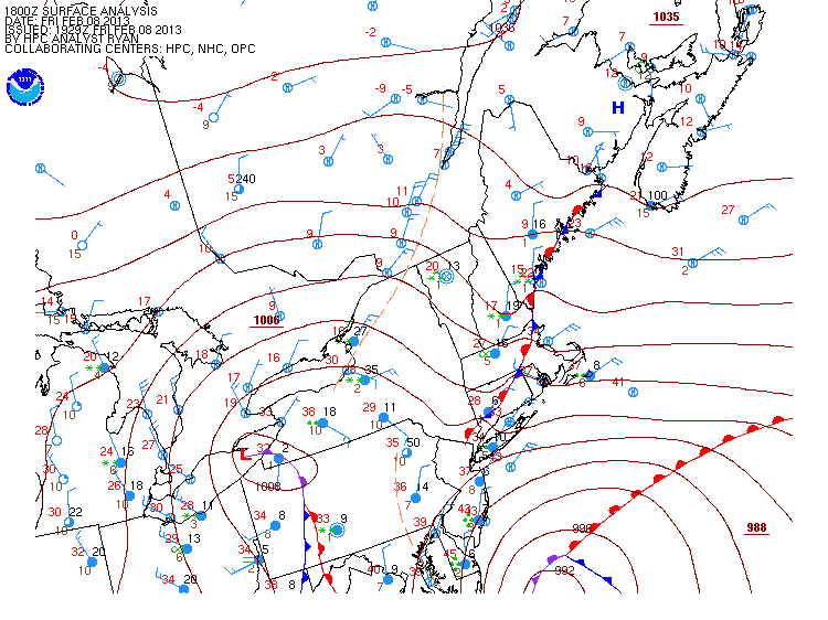
The storm has come into better focus with the expected onset of frozen precipitation ~48 hours away at post-time.  SUN/s 12z runs shifted the max snowfall action center from SW VA and smack dab into the Contest/s M-A forecast area.

Areas on the map inside the light green (10-15 mm) indicate the GFS forecast for at least 4" of snow assuming 10:1 frozen-to-melt water ratio.

HPC/s late afternoon charts restrict contest-worthy snows to the mountainous regions of WV...VA..and MD...largely a result of a 'major compromise' among competing solutions.

The contest for Storm #5 may be canceled prior to deadline if NWP indicates a fizzling event.

---
Forecast element: storm-total snowfall
Deadline for entries: 10:30 PM EST MON...04-MAR-13

Verification period begins: 12:01 AM TUE...05-MAR-13
Verification period ends: when the snow stops.

Enter your forecast at the Contest's home page here.
Follow the link from 'Enter Storm Forecast.'

---
As always...there/s no cost...or fee...or advertising...or annoying requests for personal information to enter a forecast. It's just a fun exercise for winter wx enthusiasts to see who can make the best synoptic-scale snowfall forecast.

If you are issuing your first forecast this winter...or you entered the 'season-total' forecast contest...you/ll need to create an account (user name / password / valid e-mail...if you want a copy of your forecast sent to your Inbox).

---
Want to be notified via e-mail when the 'Call for Forecast' is issued?
Send requests to 'newx at newx-forecasts dot com'.

Saturday, February 23, 2013

Winter '12 / '13 - Storm #5: Call for Forecasts!

Lighthouses at Long Point
Provincetown...MA
1875
UPDATE

Call for Forecasts - CANCELLED

12Z SAT NWP suggest not enough snow and not enough stations for a contest- worthy storm.

---
(Originally posted 21-FEB-13 @ 8:35 PM EST)

**  Early announcement b/c of other commitments tomorrow evening and an earlier than usual deadline for entries. **

'Nother nor'easter heading into the forecast area this weekend with a decent stripe of frozen precipitation progged along in the NW edge of the precipitation shield.

No cold air source to the storm/s north along with LOW/s close proximity to the coast could put the kabosch on this event.

Only snow that accumulates after midnight Sunday will be used to verify the forecasts.

The contest for Storm #5 may be canceled prior to deadline if NWP indicates a fizzling event.

---
Forecast element: storm-total snowfall
Deadline for entries: 7 PM EST SAT...23-FEB-13

Verification period begins: 12:01 AM SUN...24-FEB-13
Verification period ends: when the snow stops.

Enter your forecast at the Contest's home page here.
Follow the link from 'Enter Storm Forecast.'

---
As always...there/s no cost...or fee...or advertising...or annoying requests for personal information to enter a forecast. It's just a fun exercise for winter wx enthusiasts to see who can make the best synoptic-scale snowfall forecast.

If you are issuing your first forecast this winter...or you entered the 'season-total' forecast contest...you/ll need to create an account (user name / password / valid e-mail...if you want a copy of your forecast sent to your Inbox).
---

Want to be notified via e-mail when the 'Call for Forecast' is issued?
Send requests to 'newx at newx-forecasts dot com'.

Wednesday, February 20, 2013

Winter '12 / '13 - Interim Standings: 2

After four storms...it/s Brad Yehl...herb @maws...and dryslot.

Under the ‘two-thirds’ rule…forecasters who have entered at least three forecasts are included in these interim standings.


Full forecaster statistics table and charts here.
All forecasts from all forecasters for all storms here.

SUMSQ errors for each contest snow storm are normalized with a 'Z-score'...then averaged to compute the standings. Forecasters who have entered at least 2/3 of all snow storm contests are included in the standings.

If a forecaster has participated in more than two-thirds of all snow storm contests...then Z-scores from their 'best two-thirds' forecasts are used to calculate Interim and Final standings. Same idea as dropping the lowest quiz score before the final grade is computed.

Winter '12 / '13 - Interim Standings

UPDATE
Journeyman forecaster Brad Yehl was inadvertenly left out of the first Interim standings.
His 'Average SUMSQ Error Z-score' was -0.788...which would have put him in third place.

Apologizes to Brad for the oversight.

---
(Originally posted 02-FEB-13 @ 7:45 PM EST)
After three snow storms...it/s dryslot...donsutherland1...and Donald Rosenfeld.

Under the ‘two-thirds’ rule…forecasters who have entered at least two forecasts are included in this interim summary.


Full forecaster statistics table and charts here.
All forecasts from all forecasters for all storms here.

---
SUMSQ errors for each contest snow storm are normalized with a 'Z-score'...then averaged to compute the standings. Forecasters who have entered at least 2/3 of all snow storm contests are included in the standings.

If a forecaster has participated in more than two-thirds of all snow storm contests...then Z-scores from their 'best two-thirds' forecasts are used to calculate Interim and Final standings. Same idea as dropping the lowest quiz score before the final grade is computed.

Tuesday, February 19, 2013

Winter '12 / '13 - Storm #4: Final Results

1st - Brad Yehl
SUMSQ:7.01 
SUMSQ Z:-1.127 
STP:4.81 (3)
TAE:7.39 (1)
AAE:0.34 (1)
2nd - herb@maws
SUMSQ:14.77 
SUMSQ Z:-0.959 
STP:10.86 (5)
TAE:13.94 (2)
AAE:0.63 (3)
3rd - weatherT
SUMSQ:31.38 
SUMSQ Z:-0.600 
STP:0.61 (1)
TAE:19.39 (6)
AAE:0.81 (4)
HM - Donald Rosenfeld
SUMSQ:34.00 
SUMSQ Z:-0.543 
STP:9.50 (4)
TAE:14.10 (3)
AAE:0.61 (2)

SUMSQ: sum of square errors
STP: storm-total precipitation error
TAE: total absolute error
AAE: average absolute error
(number):  category rank

Full forecast verification and summary for Storm #4 at the Contest/s web site.

Monday, February 18, 2013

Winter '12 / '13 - Storm #3: NESIS

NESIS:  4.35 (Category 3 - Major)
Rank:  25

Source:  https://www.ncei.noaa.gov/access/monitoring/rsi/nesis

Winter '12 / '13 - Storm #4: Preliminary Verification

Preliminary storm-total snowfalls for Sunday from CDUS41...CXUS51...and PNS bulletins.

No new daily records.

Please report any errors and drop a link to the correct data in Comments.

Final results and storm summary Tuesday evening.

Sunday, February 17, 2013

Winter '12 / '13 - Storm #4: The Forecasts

Rookie 2
Intern 1
Journeyman 1
Senior 6
TOT 10


Entries ranked by STP.
166 station forecasts.


Consensus for heavy snowfall (+6") expected at HYA.  Plowable totals from CAR-BGR-BOS-PVD.


AO and PNA pulling all the weight...again.
NAO MIA...again.

Everyone/s station-by-station forecast has been posted on the Contest/s web site.

Saturday, February 16, 2013

Winter '12 / '13 - Storm #4: RAW Forecasts

RAW forecasts posted to NEWx/s GoogleGroup page here.

Friday, February 15, 2013

Winter '12 / '13 - Storm #4: Call for Forecasts!

TAKE 2!

NYC
13-DEC-69

This weekend's PD III poser of a storm didn't show its face in time to issue a  'Call for Forecasts' Thursday evening.

Today's progs and HPC guidance suggest a contest-worthy period of snow over northern stations on Sunday.

Only snow that accumulates after midnight Sunday will be used to verify the forecasts.

The forecast contest for Storm #4 may be canceled prior to deadline if NWP indicates a fizzling event.

---
Forecast element: storm-total snowfall
Deadline for entries: 10:30 PM EST SAT...16-FEB-13

Verification period begins: 12:01 AM SUN...17-FEB-13
Verification period ends: when the snow stops.

Enter your forecast at the Contest's home page here.
Follow the link from 'Enter Storm Forecast.'

---
As always...there/s no cost...or fee...or advertising...or annoying requests for personal information to enter a forecast. It's just a fun exercise for winter wx enthusiasts to see who can make the best synoptic-scale snowfall forecast.

If you are issuing your first forecast this winter...or you entered the 'season-total' forecast contest...you/ll need to create an account (user name / password / valid e-mail...if you want a copy of your forecast sent to your Inbox).
---

Want to be notified via e-mail when the 'Call for Forecast' is issued?
Send requests to 'newx at newx-forecasts dot com'.

Monday, February 11, 2013

Winter '12 / '13 - Storm #3: Final Results

1st - dryslot
SUMSQ:
570.76

SUMSQ Z:
-0.938

STP:
28.85
 (7)
TAE:
71.25
 (1)
AAE:
2.97
 (1)


2nd - iralibov
SUMSQ:
692.28

SUMSQ Z:
-0.773

STP:
5.95
 (1)
TAE:
97.45
 (3)
AAE:
4.24
 (3)
3rd - Roger Smith
SUMSQ:
768.80

SUMSQ Z:
-0.668

STP:
45.90
 (10)
TAE:
101.40
 (4)
AAE:
4.41
 (5)
HM - flame_boy
SUMSQ:
825.02

SUMSQ Z:
-0.592

STP:
39.74
 (8)
TAE:
85.28
 (2)
AAE:
3.88
 (2)


SUMSQ: sum of square errors
STP: storm-total precipitation error
TAE: total absolute error
AAE: average absolute error
(number):  category rank

Full forecast verification and summary for Storm #3 at the Contest/s web site.

Sunday, February 10, 2013

Winter '12 / '13 - Storm #3: Preliminary Verification

Preliminary storm-total snowfalls for Friday and Saturday from CDUS41...CXUS51...and PNS bulletins.

Several stations in the data table do not have SN:H2O reported b/c their liquid totals included either mixed precipitation...gross errors...or missing data.

HYA estimated STP derived from the average between Centerville (6") to the west and South Yarmouth to the east (8") per PNSBOX.

---
Six new daily records.
Double-header at MacArthur airport.

FRI...08-FEB-13
ISP - 16.7" (6"; 1994)
ORH - 15.2" (7"; 1945)
BDL - 13.4" (?"; 1945)

SAT...09-FEB-13
BGR - 16.2" (8.6"; 1969)
BOS - 14.8" (12.4"; 1994)
ISP - 11.1" (2"; 1994)


---
Please report any errors and drop a link to the correct data in Comments.

Final results and storm summary Monday evening.

Saturday, February 09, 2013

Winter '12 / '13 - Storm #3: Blizzard?

BOS
26-FEB-69
Sorry folks.
It just didn/t happen this go'round.

Despite the news media/s insatiable appetite for sensationalism...heavy snowfall does not a blizzard make.

Blizzard defined.

The only station coming even close to blizzard conditions was Islip airport on Long Island...NY but alas...they came up ~78" short on the 180" duration requirement.

The three-hour duration clock starts at 0208z (9:08 PM EST) when the visibilily fall below 1/4 SM at KISP and the wind begins to honk above 30 knots.

---
METAR KISP 090208Z 36022G35KT 1/8SM R06/1200V1600FT +SN FZFG VV003 M02/M03 A2952

METAR KISP 090256Z 35019G32KT 1/16SM R06/1000V1200FT +SN FZFG VV002 M02/M03 A2953

METAR KISP 090350Z 36018G28KT 1/8SM R06/1600V2600FT +SN FZFG VV003 M03/M04

METAR KISP 090356Z COR 34020KT 1/8SM R06/2000V2800FT +SN FZFG VV003 M03/M04

---
Three-hour duration clock stops at 0350z (10:50 PM EST).  The total elapsed time of a blizzard/s restricted visibility and wind speed criteria is 1' 42" which is 1' 18" short of the three-hour duration requirement.

Winter '12 / '13 - Storm #3: The Forecasts!

15 forecasters
10 Senior
1 Journeyman
1 Intern
3 Rookies...including 1 'first-timer'.  Welcome flame_boy!


Entries ranked by STP.
336 station forecasts.


Consensus heavy snowfall axis from CAR-BGR-PWM-BOS-HYA-PVD-ISP-JFK-EWR-BGM-ALB-BTV-CAR.  At least 20" expected at PWM...CON...BOS...ORH...and PVD.  Biggest losers in the M-A this go'round.


NAO sitting it out...again.

Everyone/s station-by-station forecast has been posted on the Contest/s web site.

Winter '12 / '13 - Storm #3: Snow Cover

Thursday, February 07, 2013

Winter '12 / '13 - Storm #3: RAW Forecasts

Raw forecasts here.

Chances are...the posting of forecasts and forecast summary on the Contest/s web page and web log will be delayed until Saturday.

Wednesday, February 06, 2013

Winter '12 / '13 - PD III ?

Winter '12 / '13 - Storm #3: Call for Forecasts!

Route 128
Danvers...MA
10-FEB-69
The last 'Call for Forecasts' came 41 days ago.  What a crappy winter!

NWP offering up another odd Miller A / B hybrid with explosive development along the SNE coast...near-blizzard conditions...and a track over the famed' benchmark' at 40°N / 70°W.

This go-round it's an actual real-live snowstorm and not some poser LOW with a thin strip of snow on the northwestern edge of the precipitation shield.

The forecast contest for Storm #3 may be canceled prior to deadline if NWP indicates a fizzling event altho that seems unlikely.

---
Forecast element: storm-total snowfall
Deadline for entries: 10:30 PM EST THU...07-FEB-13

Verification period begins: 12:01 AM FRI...08-FEB-13
Verification period ends:  when the snow stops*

Enter your forecast at the Contest's home page here.
Follow the link from 'Enter Storm Forecast.'

---
As always...there/s no cost...or fee...or advertising...or annoying requests for personal information to enter a forecast. It's just a fun exercise for winter wx enthusiasts to see who can make the best synoptic-scale snowfall forecast.

If you are issuing your first forecast this winter...or you entered the 'season-total' forecast contest...you/ll need to create an account (user name / password / valid e-mail...if you want a copy of your forecast sent to your Inbox).

---
Want to be notified via e-mail when a 'Call for Forecasts' is issued?
Send your request to 'newx at newx-forecasts dot com'.

---
* Current NWP suggests accumulating snows coming to an end Saturday evening.
Verification period may end 11:59 PM SAT...09-FEB-13 even if light snowfall is occurring over a station or two.  No reason to hold up the preliminary verification report to count 12 extra snowflakes somewhere.

Tuesday, February 05, 2013

Winter '12 / '13 - 12th Annual 'Season-Total' Forecast Contest: DEC / JAN Totals

DEC/s snowfall totals got the season off to a promising start with nine stations measuring above normal snowfall and 103% above normal for the entire forecast area where northern stations got the best of it.  Total departure was +5.7".


All stations measured below normal snowfall totals in JAN for a total departure of -139.5".  Three southern stations made it into the Top Ten.

As of the end of JAN...season-total snowfall over the entire forecast area was 28% below normal.

---
GREEN - 75th percentile and above
RED - 25th percentile and below

Tuesday, January 29, 2013

Monday, January 21, 2013

Winter '12 / '13 - Storm #3: MR Teaser

Long-range progs continue to offer a contest-worthy storm toward week's end for the northern M-A and SNE.


UL:  500 mb Z and PMSL
UR:  500 mb Z and vorticity
LL:  PMSL and precipitation type
LR:  PMSL and 2m Td

Today/s 108-hour solutions from the 12z GFS suggest initial forcing from-low level warm air advection followed by a modest measure of mid-level intensification as the system approaches the SNE coast.

Should this scenario come to pass...
Call for Forecasts:  Wed evening...23-JAN-13
Deadline:  10:30 PM EST Thu...24-JAN-13

---
Images courtesy Meteocentre.com

Winter '12 / '13 - Arctic Oscillation: Meteorological Winter/s Mid-point

Not sure what if anything it means but here's the state of the AO at the mid-point of meteorological winter during its 64 year period-of-record.


Blue line is the observed AO on 15-JAN.

Red line is a 9-point binomial filter.  The filter removes noise from the signal to highlight trends.
Yellow line is an 11-year moving average.

The 15-JAN-13 AO (-0.646) ranks 26th (41th percentile).


Same idea for AO/s sister...the North Atlantic Oscillation (NAO).
The 15-JAN-13 NAO (0.011) ranks 26th (41th percentile).

Three things to note...
1)  The highly variable AO index on D+45 compared to its sister index...then NAO.
2)  The 11-year moving average between 1960 and1980 is negative...followed by a 30-year period were the average is above zero.
3)  This season/s mid-winter AO and NAO values are slightly below normal for all mid-winter values during the period-of-record (Z = -0.207 and Z = -0.045, respectively).

Wednesday, January 09, 2013

Winter '12 / '13 - Stratospheric Sudden Warming: Watch #2

UPDATE #3
Current SSW event can now be classified as a major warming.  Temperatures have increased ~50°C in less than seven days AND zonally averaged winds @60°N have turned easterly.


Max 10 mb (31,242m; ~50K') temperature @12z today was -22°C (-7.6°F) over Viljujsk...Russia (map).

Why is SSW matters...

Pronounced weakenings of the NH wintertime stratospheric polar vortex tend to be followed by episodes of anomalously low surface air temperatures and increased frequency of occurrence of extreme cold events throughout densely populated regions such as eastern North America, northern Europe, and eastern Asia that persist for ~2 months.
http://www.nwra.com/resumes/baldwin/pubs/Thompsonetal_2002.pdf

Pronounced weakening of the PV (cool colors) as it splits in two bya strong anticyclone advancing on 90°N...


10 mg height analysis courtesy JMA.


Warm colors indicate east wind.  Polar wind field along left edge of frame.  Anticyclonic circulation is strongest above 10 mb and extends to surface.  Blue action center near 30N @ 200 mb is the sub-tropical jet.

Height-Latitude Cross Section of Zonally Averaged Zonal Wind image courtesy JMA.

---
UPDATE #2 (7-JAN-13 @ 7:08 PM EST)

North- South 0° - 180W°
East - West 90°E - 90°W

Minor warming under way...evidenced by the sharp increase in temperature at 10 mb (> 25K) over the Pole in less than a week's time.  A 'major' warming classification requires the same rapid temperature increase and the PV to become easterly at 60°N at 10 mb or below.


Just a hint of the warming down to ~30 mb along seen on the right edge of the above image.


Not the wave flux above 100 mb...especially in the final frame...where the 'hot' colored vectors veer toward the pole indicating energy propagating from the troposphere into the poleward Ignorosphere.


ECMWF forecasts the PV to bifurcate and maintain that state through D+10 as anticyclone builds over 90N.  CW has it the anticyclone propagates to the surface in a few weeks where -AO becomes established.  Some unknown location in the mid-latitudes can probably expect a Mother lode of cold toward the end of January.

---
UPDATE #1 (30-DEC-12 @ 1:58 PM EST)
Strong anticyclone forecast at D+10 (blue region in upper right of frame).

Wednesday, January 02, 2013

Winter '12/ '13 - Arctic Oscillation: Is December A Leading Indicator?

UPDATE
December AO:  -1.749
Rank:  11th (17th percentile)

---
Original post date:  26-DEC-12 @6:31 PM EST

Little doubt DEC/s index will come in negative given the 30-day moving average stands at -1.965.

Does the sign of DEC/s AO have any predictive value?  The sign of NOV/s AO was shown to have predictive value for the sign meteorological winter/s (D-J-F) average AO.

The 2x2 contingency table of DEC/s AO index and JAN/s index shown below suggests there/s a strong association between the two...especially when DEC/s AO is < 0.

Each cell in the table shows the number of years where the sign of the DEC/s AO was associated with the sign of JAN/s AO.


When DEC/s AO is < 0...there/s an 82% chance the JAN/s average AO will also be negative. 

The table/s precision is 74%...where precision is the proportion of negative cases predicted correctly [a / (a + c)].  The probability of a 'false positive' (-AO forecast; + AO observed) is 36%.

Winter '12 / '13 - Arctic Oscillation: Day 31

Not sure what if anything it means but here/s the state of the AO on Day 31 of meteorological winter during its 63 year period-of-record


Blue line is the observed AO on 31-DEC.
Red line is a 9-point binomial filter.  The filter removes noise from the signal to highlight trends.

The 31-DEC-12 AO ranks 31th (52th percentile). 


Same idea for AO/s sister...the North Atlantic Oscillation (NAO).
The 31-DEC-12 NAO ranks 53th (84th percentile).

Winter '12 / '13 - Long Range Forecast: Farmer/s Almanac

Two Towers - New York
Alfred Stieglitz
OCT-1911

January 2013
1st-3rd. Showery, then clearing and cold. Wet for Mummers Day Parade in Philadelphia.
4th-7th. Storm sweeps across Pennsylvania and New York with gusty winds and heavy precipitation.
8th-11th. Blustery and colder; snow showers.
12th-15th. Mostly fair.
16th-19th. Wet, then fair and cold.
20th-23rd. Heavy snow (half foot or more) for New England; lighter amounts farther south.
24th-27th. Scattered flurries.
28th-31st. Sharp cold front brings rain and snow showers, then clearing and cold.

February 2013
1st-3rd. Fair.
4th-7th. A sharp cold front brings gusty winds, rain, and snow showers.
8th-11th. Unsettled; light snow and flurries.
12th-15th. Major Northeast snowstorm develops: some accumulations could exceed one foot; strong winds cause considerable blowing of snow.
16th-19th. Lingering snow showers, flurries.
20th-23rd. Blustery and cold.
24th-28th. A major storm over the ocean perhaps brushes the coast with light snow and gusty winds, then turning fair.

More...

Winter '12 / '13 - SOI: December


December/s SOI (Southern Oscillation Index) came in at -6 after three consecutive months where the index went above zero.

A negative SOI is associated with above normal sea surface temperatures (SST) in ENSO Region 3.4 in the tropical Pacific.  Sustained SOI < -8 indicates el Nino.

Weekly SST anomalies from Region 3.4 have been running a tenth or two below normal the past four weeks causing the 12-week moving average to fall to 0.18 (neutral-warm).


ENSO Region image courtesy CPC