Thursday, January 26, 2012
Monday, January 23, 2012
Winter '11 / '12 - Snow Storm #1 - Final Results
![]() |
Mid-Atlantic/s warm and runny 'nose-of-doom' |
herb@maws | ||
SUMSQ: | 35.15 | |
SUMSQ Z: | -1.012 | |
STP: | 5.80 | (2) |
TAE: | 19.60 | (1) |
AAE: | 0.82 | (1) |
donsutherland1 | ||
SUMSQ: | 39.49 | |
SUMSQ Z: | -0.900 | |
STP: | 11.55 | (4) |
TAE: | 19.75 | (2) |
AAE: | 0.82 | (2) |
Brad Yehl | ||
SUMSQ: | 45.16 | |
SUMSQ Z: | -0.752 | |
STP: | 1.85 | (1) |
TAE: | 23.65 | (3) |
AAE: | 0.99 | (3) |
weatherT | ||
SUMSQ: | 61.20 | |
SUMSQ Z: | -0.336 | |
STP: | 13.29 | (5) |
TAE: | 27.49 | (5) |
AAE: | 1.15 | (5) |
STP: storm-total precipitation error
TAE: total absolute error
AAE: average absolute error
(number): category rank
Sunday, January 22, 2012
Winter '11 / '12 - Outlooks
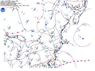
From CPC (0.5 month lead)...
La Nina continuing to hold sway over the forecast area for the last month of meteorological winter.
More winter Outlooks after the jump.
Winter '11 / '12 - Snow Storm #1 - Preliminary Verification
Preliminary storm-total snowfalls for Saturday from CDUS41...CXUS51...and PNS...as of noon Sunday.
The storm-total snowfall for HYA is an estimate derived from vicinity reports in Barnstable county carried in the PNSBOX bulletin.
Several stations in the data table do not have SN:H2O reported b/c their liquid totals included mixed precipitation.
---
Two new daily records.
Saturday...21-JAN-12
PVD - 7.6" (6.6"; 1976)
BDR - 6.2" (6"; 2001)
Please report any errors and drop a link to the correct data in Comments.
Final results and storm summary Monday evening.
Saturday, January 21, 2012
Winter '11 / '12 - Snow Storm #1 - The Forecasts
Welcome back everyone.
The kick-off event was a l-o-n-g time coming. Here/s hoping it/s not the last!
Eight entries.
6 Senior forecasters...including NEWxSFC/s Chief forecaster donsutherland1
1 Journeyman
1 Intern
Congratulations to...
WeatherT on being promoted to Senior forecaster
Roger Smith on being promoted to Journeyman forecaster
Brad Yehl on being promoted to Intern forecaster
NEWxSFC/s Chief forecaster is the winner of last year/s 'storm-total' contest.
Senior forecasters have a minimum of three years experience.
Journeyman forecasters have two years experience.
Intern forecasters have one year experience.
Rookie forecasters are rookies.
---
All forecasts have been posted to the Contest/s web site.
Follow the 'Winter '11 / '12 Storm Contest Forecasts Storm #1' link.
Entries are ranked by 'storm total' forecast.
Max: 78" (Mitchel Volk)
Avg: 56"
Median: 54"
STD: 15"
Thursday, January 19, 2012
Winter '11 / '12 - Snow Storm #1 - Call for Forecasts
![]() |
c.1890 |
A weak frontal wave rising out of the OH-TN river valley early Saturday morning will throw Atlantic moisture atop an arctic air mass parked over SE Canada.
Looks to be a borderline nuisance event but at this point in a rather disappointing season...we/ll take it.
The contest may be canceled prior to the deadline if NWP indicates a fizzling event.
---
Forecast element: storm-total snowfall
Deadline for entries: 10:30 PM EST FRI...20-JAN-12
Verification period begins: 12:01 AM SAT...21-JAN-12
Verification period ends: 11:59 PM SAT...21-JAN-12
Enter your forecast at the Contest's home page here.
Follow the link from 'Enter Storm Forecast.'
---
As always...there/s no cost...or fee...or advertising...or annoying requests for personal information to enter a forecast. It's just a fun exercise among winter wx enthusiasts to see who can make the best synoptic-scale snowfall forecast.
If you are issuing your first forecast this winter...or you entered the 'season-total' forecast contest...you/ll need to create an account (user name / password / valid e-mail...if you want a copy of your forecast sent to your Inbox).
Want to be notified via e-mail when a 'Call for Forecasts' is issued?
Send your request to newx at newx-forecasts dot com.
Tuesday, January 17, 2012
Winter '11 / '12 - Season Opener?
GooFuS has been busy pumping out promising progs with shiny stellar dendrites dangling over the forecast area this weekend for what could turn out to be this winter/s season opener contest-worthy snow storm.
Sunday, January 15, 2012
Winter '11 / '12 - Sudden Stratospheric Warming Watch - Update 6
The minor warming criterion (25°K increase over seven days at any level in the winter hemisphere) has almost reached the 30 mb level. A mere two or three degrees to go.
Major warming criteria is on the verge of being breached.
A major warming is defined as "...westerly winds at 60°N and 10 mb...become easterly [...]. A complete disruption of the polar vortex is observed and the vortex will either be split into daughter vortices, or displaced from its normal location over the pole."

Westerly winds at 85°N and above 10 mb have reversed.
'Complete' distruption is a stretch given the D+10 forecast. There's more blue (easterly mean zonal wind) in the several panels leading up to D+10; however...the PV is also expected to re-intensify.
...but a displaced 10mb PV is carried in the forecast.
Another important indicator of stratospheric warming is E-P flux. Apparently...when the flux vector field leans toward the pole...as shown in the analysis between 11-JAN and 13-JAN...stratospheric warming is underway.
Previous update here.
Winter '11 / '12 - Arctic Oscillation - On the Cusp
![]() |
NYC - East 46th St. near 2nd Ave. 16-JAN-65 |
The polar vortex (PV) has been wicked strong until recently when it weaken slightly during the on-going minor stratospheric warming. Minor warmings are not known for their association with PV-reversals...so there's little expectation this event will be reflected at the surface in the form of a negative AO.
What a difference a year makes. Last December/s monthly AO was the second lowest (-2.631) during the period of record which began in 1950. JAN-11 didn't stand out in the historical record (ranked 14th) but it was strongly negative. This winter...December was the polar opposite at +2.221. January is on-track to finish...not unexpectedly positive...around +1.
---
Below is a time-series of the AO on winter's cusp throughout the 60+ year period of record (1950 - 2011). The blue line is a trace of the daily AO index on 15-JAN. The dark red line is a a trace of the same data after applying a nine-point binomial filter. The filter removes low frequency noise and highlights decadal trends.
Not sure what this says about the AO on 15-JAN other than there is a discernible cycle every nine years or so. It does have an interesting comparison to the cycles found in the 30-DEC data.
Thursday, January 12, 2012
Winter '11 / '12 - North Atlantic Oscillation - About Face
NAO dips below zero for the first time in 55 days (-0.082 on 17-NOV-11).
Question now is will it last and if it does...how strong will it be? Current GooFuS and its ensemble forecasts hold out little hope...
Arctic Oscillation (AO) forecasts are another...more promising story...
For many NEWxSFC forecast stations...a negative AO plays a bigger role than a negative NAO for contest-worthy storms.
Related posts:
Going Negative
Going Negative - How Much for Philly
Going Negative - How Much for DC?
Going Negative - How Much for Dulles?
Daily teleconnection data here.