Saturday, December 09, 2006

Waiting for -AO


Having arrived on the doorstep of the '06 / '07 winter ragged and disheveled with hearts shattered from past season/s disappointments...we look longingly and lovingly to the Pro METs whose vision of future events own us all.

How much for Philly?

While feasting on tales of warring indices...3-D mass fluxes...and seasonal anomalies...the Pros throw us a few scraps and bone or two to keep our interest...only to find the -AO won/t be coming today but it will surely be here tomorrow.

But when tomorrow comes...the Pros suddenly go blind and proclaim just because the -AO hasn/t arrived...they can/t see where their forecast is wrong and yet...if we just wait until tomorrow...then -AO will come.

If we/re stuck waiting for -AO...shouldn/t we just move along...but we wait anyway...knowing full well -AO may never come.

There was...and still is...a widely held expectation that the dominant planetary flow regime this winter would comport itself in such a way to produce net negative index values of the Arctic Oscillation (AO) and the AO/s first-cousin...the North Atlantic Oscillation (NAO).

So...how/s that forecast working out? AO this month to date is 1.55 sigma. NAO at 0.648 sigma.

As we moved into meteorological fall...the AO was about one-half sigma above the normalized monthly mean for September (0.606) and November (0.521). October was a different animal coming is just over one sigma (-1.029) below the mean.


The AO is a measure of polar vortex/s circulation. When the index is negative...the vortex is weak. This weakness allows arctic air to escape...some would say drain...into lower latitudes. When the three-week moving average index of daily values is positive like it is now and has been since the second week of November...the vortex is strong and arctic air is contained.

So what/s going on? What other index gives a measure of the polar vortex? QBO...perhaps?

The QBO has been red hot from the west since April. It/s eight months into its warm cycle with about five months to go before it flips east.

When QBO is anomalously strong from the west...as it is now and has been since May...it indicates the polar vortex is cold and strong...which is complementary...and more importantly...coupled to a positive AO index.


As long as QBO is west...seems to me we/re stuck until spring waiting for -AO.

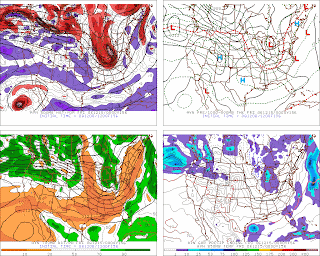
Fantasy 312 - How Much for Philly?

Click to animate. Loop speed = 5 sec / frame

For entertainment purposes only.
Warranties neither expressed nor implied.
User assumes all risk.
Not intended for use by children or to influence decisions to purchase bread, milk, and eggs.

Friday, December 08, 2006

Coastal Teaser #2 - One Step Closer

For your consideration - 00z 12/15 @ 156 HRS


Baggy...negative mid-lvl trof and a Miller 'B'. More than one system this fall has plunked a large luggie of cold air deep into the lower latitudes and coughed up a strong coastal cyclone. Interesting change depicted in the PAC NW where progged amplitude of LW is increasing and the coast-to-coast wave length is shortening. Will need 2m temps to get on-board.

Joe 'Big Snows' D'Aleo

The Gloucester Daily Times in Gloucester, MA published an article with some quotes from Dr. Joe D'Aleo today called... "Despite mild weather, a bear of a winter is in the forecast."

What caught my eye in this general interest story was Dr. Joe/s hefty snowfall forecast for parts of eastern Mass. Riding this winter/s moderate el Nino...he/s going 200% climo with 70-76" for the area.

Dr. Joe likens this winter/s potential to the '02 / '03 el Nino where Cape Ann picked up almost 120" (50" is average) and Boston saw 71.3". That winter ranks as the 4th best MEI analog this year but PDO E flipped W by late summer (the opposite of this year) and QBO ended its positive run in December which won/t happen this year. This analog may be illustrative as to how el Nino years can produce good snows...but it isn/t one of the better matches.

He also noted the snows from the '04 / '05 el Nino when Boston got 86.6". That winter is the 6th ranked MEI analog for '06 / '07. PDO ranks 9th and QBO 11th. Not a terrible analog...but there are better ones.

For each of his analog years...BOS almost picked up its normal yearly snowfall (43.3") in one month/s time. In '02 / '03...a big dump of 41.6" came in February...more than half coming from from the PD2 storm (23.6"). During '04 / '05...43.3" of snow came in January...22.5" over two days on the 22nd and 23rd.

So...what about '57? Near normal with 44.7"...most of it (23.9") falling in February.

Thursday, December 07, 2006

Coastal Teaser #2

For Your Consideration - 00z 12/15


Other than noting bagginess in mid-lvl geo-height fields...offered without comment.

MEI - October / November '06

Latest Multivariate ENSO Index (MEI) comes in @ 1.293...up 26% from 1.027 during Sept / Oct.

Klaus Wolter of NOAA's Earth System Research Laboratory - Physical Science Division notes this is the 5th highest of all Oct / Nov values and the highest ranked value since Apr / May '98.

Wolter expects +ENSO to remain moderate (near +1)...if not stronger (near +1.5 or higher) into early '07. His analog years are 1951-2, 1963-4, 1976-7, and 2002-3. Not sure why '86 / 87 wasn/t included since it lines up so well with the the '06 YTD observations on a regression line.

'57 is ranked 7th as an MEI analog. The '57 QBO is ranked 5th and is the only top-ranked QBO year during +ENSO. Even the '57 PDO is close...although the current index leads the historical by three months...there are intriguing similarities.


MEI - '06 (observed) and '57 (analog) YTD (Dec/Jan - Oct/Nov)

'57 snows were quite good in NE and especially so across the M-A.


Too bad analog forecasting produces such poor results.

Wednesday, December 06, 2006

NAO - MET Office Winter Forecast '06 / '07

The UKMET Office issued their Winter Forecast yesterday.

Temperature across Europe - slightly above climo with occasional cold outbreaks. In the UK, December is expected to be mild with colder temperatures during mid and late winter.

Sounds vaguely familiar.

Precipitation across Europe - equal chances for above or below normal. In the UK, they expect normal to slightly above normal.

Sounds like they/re expecting a +NAO to dominant this winter...which is au contraire to many US forecasters who 'see' the opposite as the most likely outcome.

The Brits have been torturing the NAO index in recent years in a dogged attempt to make it confess to what it knows about the coming winter. The MET Office claims their winter NAO forecasts...which are based on May/s SST anomalies in the NW Atlantic near Newfoundland... have a 66% accuracy regarding it/s sign.


May SST Pattern - Winter Z500 Pattern


May 2006 SST Anoms

Nothing negative about the correlated 5H pattern this season.

Tuesday, December 05, 2006

NAO - November '06

GACK!

Near-normal NAO but still...0.440 is disappointing to those eager for a quick transition to winter weather. Not that November/s number comes as any surprise seeing how mean monthly temperatures in the NE and M-A were well above normal.

RIC +4.7
IAD +3.4
PHL +4.4
BGM +5.4
BDL +5.0
BTV +5.7
BOS +4.2
PWM +5.5
CAR +6.1

With the addition of November/s datum...top three NAO analog years for this winter ('52...'81...'02) hold fast. '94 moves up one click to 4th, '80 sinks to 6th, and '01 moves into 5th. '02...which had very good snows for most stations in NE and the M-A except ORF and RDU....also shows up in the top five SOI analog years.

CW has it this season would be cold and stormy in the E...strongly influenced by +ENSO and -NAO. So...what/s up with the LR progs continuing their depiction of high index flow across the CONUS with a strong...fast PAC jet well into Week2.

No need to panic...yet. Only five days into MET winter and there/s a whole lotta winter to go.

Monday, December 04, 2006

SOI - November '06

This just in to the NEWxSFC newsroom...November/s SOI is -1.4. Still negative but not as strong as last month/s -15.3. In any event, el Ninner is still in play.

'63...'01...'57...and '02 were the hot picks for analog years last month and there/s no change after incorporating November/s index. It comes as no surprise some of these SOI analog years ('63 and '02) are also the top picks based on the MEI.

Interesting to note...'57 shows up in the top five years for QBO...as well and the winter of '57 was a very good snowfall season across the NE and M-A.

Going back in time to the SOI/s 'Big Bang' in '76 as in 1876...the SOI YTD fits best with '11 and '25...but it/s difficult finding other tele-connected indices and snowfall data back that far such that the 'eligible' analog years begin in 1950 b/c that/s when most of the other index data begin.

SOI - '06 YTD
12.7
0.1
13.8
15.2
-9.8
-5.5
-8.9
-15.9
-5.1
-15.3
-1.4

Sunday, December 03, 2006

QBO - November '06

Latest QBO comes in @ 10.10...hot on the heels of October/s 10.86. Top three analog years since 1948 are still 1990...1971...and 1969 based on regression and R² analysis for QBO values YTD. '90 had a neutral ENSO...'71 was cold...but '69 was warm as is '06.
1969/1970 snowfall @ RIC was 14" and near the period-of-record normal. 1957 was a good match using regresson...but the R² value didn/t make the top 10.

The winter of '69 snows were generous to interior NE stations such as BTV...ALB...BGM...BDL...and MDT but near-normal to occasionally below-normal elsewhere.

"The QBO determines the character of the early winter, leading to a colder and more stable polar vortex in December and January during the west phase of the QBO and a more disturbed and warmer Arctic during the east phase of the QBO.

The solar cycle influences the latter part of the winters when a clear difference is observed between periods of high and low solar activity. During high solar activity the winters in the west phase of the QBO tend to be disturbed and are often connected with Major Midwinter (stratospheric) Warmings." - anon

Solar activity has been anything but high for a long time...so don/t look for any dramatic height falls over the Arctic.

QBO since January '06...
-18.83
-11.24
-0.38
5.00
10.36
11.47
10.75
9.10
10.20
10.86
10.10