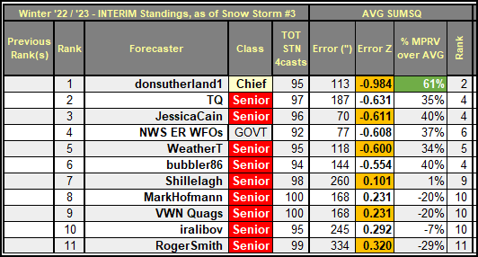
Winter '22 / '23 - Regular Season: Interim Standings #2
After 4 contest-worthy snow storms ... under the ‘two-thirds’ rule … forecasters who have
entered at least 3 forecasts are included in Interim Standings #2.
 Complete interim statistics table and chart at the Contest/s web site (direct link)
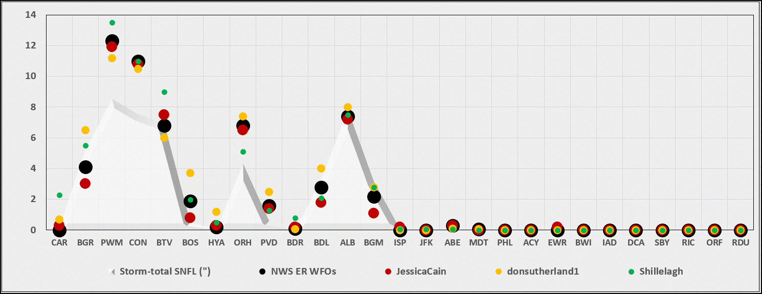
Forecaster statistics for Winter '22 / '23 contest snow storms (direct link)
---
SUMSQ errors for each Contest snow storm are normalized (i.e., standardized) with a 'Z-score' ... averaged then ranked to compute the standings. If a forecaster has issued forecasts for more than two-thirds of all snow storm contests ... then Z-scores from their 'best two-thirds' forecasts are used to calculate the Interim and Final standings.
 Complete interim statistics table and chart at the Contest/s web site (direct link)
Forecaster statistics for Winter '22 / '23 contest snow storms (direct link)
---
SUMSQ errors for each Contest snow storm are normalized (i.e., standardized) with a 'Z-score' ... averaged then ranked to compute the standings. If a forecaster has issued forecasts for more than two-thirds of all snow storm contests ... then Z-scores from their 'best two-thirds' forecasts are used to calculate the Interim and Final standings.