Friday, December 15, 2006

Michaelangelo: The Clock/s Ticking Dude

The restlessness is palatable and it has the unmistakabe taste of anchovies.

Will this year end up being another Steinbeck winter of discontent?

If you need a sports metaphor to know where we are at this point...it/s 3rd and 10...10 minutes into the first quarter.

The home team is scoreless and coming to bat in the bottom of the second inning. So what if we boggied the first three holes. Still believe we/ll own the back nine.


Models can tease all they want but the cold air just ain/t there over here. It/s all over there in Uzbekistan...Kyrgystan...Hotdogstan... and Trashcanistan.


Granted...it/s only the middle of December...a mere 15 days into MET winter. The Id assures us there are at least 75 days to go but come on...


Rationalization #2
It/s an +ENSO winter. Past Decembers have been wet and warm. Janaurys have been cold but sometimes dry. February/s the month to die for...right?

Rationalization #3
The month of March is still in play for New England... which adds a least another 15 days to the season.

Rationalization #4
QBO-W flips early. Beckett stops waiting for -AO. Cold sub-surface temps in ENSO region 3.4 coming on quickly. Solar minimum nears nadir. Moon enters 7th house. Jupiter rising. Bad Moon rising...too.

And the clock/s still ticking dude.

Thursday, December 14, 2006

Hey Dude, Where/s My Snow?

Apparently it/s on the other side of the globe where snow has been causing major traffic trubbles of late in Krasnoyarsk...Russia.

Back in the day, Krasnoyarsk was a small part of the vast Union of Soviet Socialist Republics. The Siberian city of ~1x10⁻⁶ people is located ~1000 km N of Mongolia and about the same distance NE of Kazakhstan. Other nearby republics once under the thumb of the ol' USSR are Kickstan...Hotdogstan...and Trashcanistan...but I digress.

City authorities report ~300 accidents occurred today...not because of the snowy weather...but because of 'careless drivers' who don/t drive at the 'appropriate speed' given the 'complicated' wx conditions and they/re driving on summer tires with 'worn out protectors.'

Krasnoyarsk/s 'special services' were apparently not up to the task of 'sprinkling the roads' because there was too little special equipment and the 'schedule of snow cleaning and road sprinkling was violated.'

Despite the on-going chaos on local highways...the mayor found time to meet with Father Frosts and Snow Maidens to make final preparations for the upcoming New Year celebration.

"There will be 38 fir-trees in the yards in Soviet district, the biggest district in Krasnoyarsk. A Local Father Frost noted "there will be plenty of surprises at the main district fir-tree." "

"Sverdlovsky district Father Frost told a lot of residents had been removed from dilapidated accommodation to new apartments in his district in 2006. Apart from that, the water pipe on the Bazaikha River was changed into a new one..."

The city has been named the 'most dynamically developing town' of Russia this year.

As if that wasn/t enough excitement for one day...the city announced a dating agency for animals will sponsor a booth at the upcoming 'New Year Fairy Tale' trade show.

All of which begs the question: can it be harmful to live with too much snow?

Phallacy of Measuring Snowfall


Roger Edwards...besides working @ NWS/s SPC...maintains a web log called 'Weather or Not' where he posts under the nom de plume 'Tornado.'

Today...Tornado writes about his perceived fallacy concerning snowfall measurements...maintaining the musical question..."How much snow did you get?"...doesn/t matter one lick b/c all that/s really important is the water equivalent of those billions of frozen hydro-meteors piled up around his house.

To support this crumudgery...he cites as reasons the inherent uncertainty in getting accurate measurements b/c of blowing and drifting...variability of snow:H2O ratios...and a nebulous requirement to take an unspecified number of samples...which are later averaged.

Tornado demands scientific meaning from his atmospheric phenomenon declaring "(s)now depth measurements are arbitrary, inconsistent, misleading and hugely unscientific way to represent fallen winter precipitation."

But that attitude surely misses the point about why snow must be measured with a stick and not a cup.

Sure...snow can be viewed as just 'fallen winter precipitation' but who...other than Tornado and maybe Bartlo...could possibly get excited about a 36-HR water equivalent GooFuS prog for a nor-easter deepening off the SC coast?

Can you imagine the headlines on NWS winter storm advisories...watches...and warnings?

"Winter Storm Warning for Pressure Falls...NY
Heavy Snowfall with up to 3/4" Water Equivalent"

Or a second period zone forecast where 'additional snow accumulations between 1/4" to 1/2" water equivalent.

If measuring water equivalent became the standard...what would it do to Schwartz' Admonition? Schwartz found in an observational study conducted during the mid-80s...the amount of observed snowfall was inversely proportional to the excitement at the map wall.

Beside, which forecasting contest do you think would generate more interest? One that forecasts 'water equivalent or one that forecasts 'storm-total snowfall?'

How about a scenario where a principal has to make a decision about whether to close schools b/c of a winter storm based on the expected 'water equivalent?' Mike4Snow can take this one from here.

Arguing the phallacy of snowfall measurements is just being a dick in the mud. If this idea ever comes to pass...just shoot me.

Wednesday, December 13, 2006

PDO - November '06


Woo-hoo! -0.22

The last five months have also been negative but the inter-decadal oscillation of the PDO is revealed by a five-year running average of values for October - March. The cool-season average going into this winter was weakly negative @ -0.15 driven mainly by two month/s of strongly cold values during the fall of '05.

5-yr MAVG and Yearly PDO

Charting the PDO since 1915 produces a 'smooth' sinusoidal wave where the inter-decadal variability is readily apparent. Apparent that is...until the late '80s / early '90s when the pattern becomes fragmented.

The five-year moving average going into this winter was warm (0.30) as was the preceding year (0.33). The five years prior ('00 - '04) it was negative or just below zero. Going back a few more years further reveals the same weak back-n-forth signature; however, the forays into negative territory were less than one sigma of the mean during the current period...which began in 1980... when values are generally positive.

Despite the recent inter-annual variability...the five-year running average shows we/re in the positive phase of the oscillation.

The historical record of teleconnection indices varies from 1876 for the SOI to 1950 for many others such as QBO...MEI...AO...and NAO. The snowfall period of record varies too...so when evaluating analog years...1950 is usually the earliest.

Whether evaluating the current year/s PDO against the full period beginning in 1900 or only considering years since 1950...the best analog year is 1960...as it was last month.

The problem with '60 is there was a neutral ENSO that winter. All of the Top Five PDO analog years occurred during neutral or cold ENSOs.

So where/s all this analysis take us? Does it reveal anything about the coming winter?

Maybe. Probably not.

Negative phase is correlated with above normal heights over the SE...which is a characteristic of La Nina.

Positive phase finds warm water collecting along the west coast...low SLP over the Aleutian Is. and cold SSTA between 20°N and 60°N. These synoptic features would favor a LW pattern of ridge-W implying +PNA and would complement the fx of +ENSO. +PDO is positively correlated with +ENSO.


__________________________


5H Z correlations to +PDO similar to +PNA


Temperature and Precipitation correlations to +PDO
show cooler and wetter in the E


SST observed, weekly SSTA, monthly SSTA, and seasonal SSTA
Click to animate. Loop speed = 3 sec / frame

So, where are we so far?
+ENSO - check
+PNA - still waiting
Warm water along west coast - not so much

PDO as a leading indicator seems to be a wash this year. No signature features and all the best analog years are conflicted with the current ENSO phase.

Most graphics and background information from Mantua.

Monday, December 11, 2006

+ENSO Reaches Moderate Strength

Quibblers might claim since the threshold for a moderate event is 'near 1'...the current ENSO reached that point last week when the 12-week moving average was 0.95°C......but this week/s 3.4 anomaly of 1.4°C nudged the number just over the top.


So if we/re on the threshold of a moderate +ENSO...where/s this LW pattern that we expect to accompany these SSTs?


Instead...we have this over NOAM today...


Hold the despair. There are similarities in the planetary flow this year compared to the onset of the last +ENSO.

The previous +ENSO began during the late summer of '04. The region 3.4 anomaly stayed at or slightly above 0.75°C from the fall through mid-winter before fading by early spring.

In the run-up to that winter from 11/1 through 12/9...the mean LW regime over NOAM was...


And this is where we are today for the same period...


Not much difference, eh?

Compare that to the mean 5H Z during the '04 / '05 +ENSO/s MET winter.

That/s more like it! Ridge-W, Trof-E and split flow across the southern tier.

This strongly suggests we might just have to take our shoes off and sit a spell before the main event gets a'goin'. By the end of Dec '04...the LW pattern had transitioned to one more akin to the 5H composite for +ENSO winters (as shown above).

The snows of '04 were generally near or below period of record normal (PORN) in the Mid-Atlantic and better than PORN across New England.


Keep your snow pants on...it/ll get here when it gets here.

Sunday, December 10, 2006

Eenie Meanie...Chili Beanie - The Spirits Are About To Speak!

Click to animate. Loop speed = 3 sec / frame

Fast...hi-index flow regimes can/t last forever. If they did...it wouldn/t be Planet Earth where differential sfc heating and orography play key roles in the creation and propagation of weather producing Rossby waves.

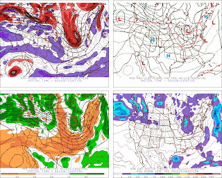
Today/s ECMWF progs depict a buckling in the hi-index (zonal) LW flow regime over the PAC early in the forecast period. By D+7...a deep trof b/comes established in the W and a heat ridge bulges over the SE.

This trof-W, ridge-E configuration is not immediately favorable for winter wx along the EC but there/s little reason to think this evolving pattern will become dominant beyond D+7 b/c 1) the forecast five-wave pattern is by definition progressive and 2) we/re in the midst of a moderate +ENSO which is not conducive for persistent SE ridging.

Also notable by D+7 is the lowering (rising) 5H heights over the Azores (Greenland) suggestive of a developing hi-lat block.

Given the hi-amp western ridge just upstream of the cold pool in the full-latitude western trof...the upr LOW could retrograde into a 'bowling ball' as the progressive ridge rolls over then aligns near 125W.

Moose: Eenie meanie, chili beanie--the spirits are about to speak!
Squirrel: Are they friendly spirits?
Moose: Just listen.

Saturday, December 09, 2006

Waiting for -AO


Having arrived on the doorstep of the '06 / '07 winter ragged and disheveled with hearts shattered from past season/s disappointments...we look longingly and lovingly to the Pro METs whose vision of future events own us all.

How much for Philly?

While feasting on tales of warring indices...3-D mass fluxes...and seasonal anomalies...the Pros throw us a few scraps and bone or two to keep our interest...only to find the -AO won/t be coming today but it will surely be here tomorrow.

But when tomorrow comes...the Pros suddenly go blind and proclaim just because the -AO hasn/t arrived...they can/t see where their forecast is wrong and yet...if we just wait until tomorrow...then -AO will come.

If we/re stuck waiting for -AO...shouldn/t we just move along...but we wait anyway...knowing full well -AO may never come.

There was...and still is...a widely held expectation that the dominant planetary flow regime this winter would comport itself in such a way to produce net negative index values of the Arctic Oscillation (AO) and the AO/s first-cousin...the North Atlantic Oscillation (NAO).

So...how/s that forecast working out? AO this month to date is 1.55 sigma. NAO at 0.648 sigma.

As we moved into meteorological fall...the AO was about one-half sigma above the normalized monthly mean for September (0.606) and November (0.521). October was a different animal coming is just over one sigma (-1.029) below the mean.


The AO is a measure of polar vortex/s circulation. When the index is negative...the vortex is weak. This weakness allows arctic air to escape...some would say drain...into lower latitudes. When the three-week moving average index of daily values is positive like it is now and has been since the second week of November...the vortex is strong and arctic air is contained.

So what/s going on? What other index gives a measure of the polar vortex? QBO...perhaps?

The QBO has been red hot from the west since April. It/s eight months into its warm cycle with about five months to go before it flips east.

When QBO is anomalously strong from the west...as it is now and has been since May...it indicates the polar vortex is cold and strong...which is complementary...and more importantly...coupled to a positive AO index.


As long as QBO is west...seems to me we/re stuck until spring waiting for -AO.

Fantasy 312 - How Much for Philly?

Click to animate. Loop speed = 5 sec / frame

For entertainment purposes only.
Warranties neither expressed nor implied.
User assumes all risk.
Not intended for use by children or to influence decisions to purchase bread, milk, and eggs.

Friday, December 08, 2006

Coastal Teaser #2 - One Step Closer

For your consideration - 00z 12/15 @ 156 HRS


Baggy...negative mid-lvl trof and a Miller 'B'. More than one system this fall has plunked a large luggie of cold air deep into the lower latitudes and coughed up a strong coastal cyclone. Interesting change depicted in the PAC NW where progged amplitude of LW is increasing and the coast-to-coast wave length is shortening. Will need 2m temps to get on-board.

Joe 'Big Snows' D'Aleo

The Gloucester Daily Times in Gloucester, MA published an article with some quotes from Dr. Joe D'Aleo today called... "Despite mild weather, a bear of a winter is in the forecast."

What caught my eye in this general interest story was Dr. Joe/s hefty snowfall forecast for parts of eastern Mass. Riding this winter/s moderate el Nino...he/s going 200% climo with 70-76" for the area.

Dr. Joe likens this winter/s potential to the '02 / '03 el Nino where Cape Ann picked up almost 120" (50" is average) and Boston saw 71.3". That winter ranks as the 4th best MEI analog this year but PDO E flipped W by late summer (the opposite of this year) and QBO ended its positive run in December which won/t happen this year. This analog may be illustrative as to how el Nino years can produce good snows...but it isn/t one of the better matches.

He also noted the snows from the '04 / '05 el Nino when Boston got 86.6". That winter is the 6th ranked MEI analog for '06 / '07. PDO ranks 9th and QBO 11th. Not a terrible analog...but there are better ones.

For each of his analog years...BOS almost picked up its normal yearly snowfall (43.3") in one month/s time. In '02 / '03...a big dump of 41.6" came in February...more than half coming from from the PD2 storm (23.6"). During '04 / '05...43.3" of snow came in January...22.5" over two days on the 22nd and 23rd.

So...what about '57? Near normal with 44.7"...most of it (23.9") falling in February.