North Atlantic Oscillation - Trending South
Blue line is NAO's five-year moving average for meteorological winter (D-J-F) which at the end of last winter dipped below zero for the first time since 1982.
Note how the 5-yr moving average was negative for 21 years between 1953 and 1973...then a nine-year transition period when the sign flip-flopped after holding serve one way or the other briefly for four or five years...followed by 27 years where the NAO's moving average was positive.

Might this herald the start of a protracted...multi-decadal period of negative winter-time NAOs?
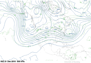
In other news...DEC-10 NAO came in at -1.85...marking the 15th consecutive month it's been below zero and the 3rd lowest index value for December since 1950. Second-lowest December was 1963. All-time record minimum is DEC-09.
Closest analog year based on least-squares analysis is 1968 / 1969 which was +ENSO...-QBO...and -PDO.
Second-closest analog year based on least-squares analysis is 1977 / 1978 which was +ENSO...+QBO (month-one of west phase)...and mixed PDO.