Sunday, October 29, 2017

Winter '17 / '18 - Eurasia Snow Cover - OCT Preview

Cohen projecting above normal Eurasia snow cover for OCT ahead of an expected weak La Nina winter (D-J-F).

Nine previous weak La Nina winters ... including the famed 1995 - 1996 season ... have been observed during the Eurasia snow cover period of record (1967 - 2016). Only two NEWxSFC forecast stations -- BGM and ALB -- have a statistically significant correlation between season-total snowfall and above normal Eurasia snow cover.


Related:
Winter '17 / '18 - Correlation of Eurasia's OCT Snow Cover and Season-total Snowfall in NE and M-A Regions 

Winter '17 / '18 - First Contact

Post-frontal ... elevation snows INVOF UVM associated with SFC LOWs

Boone ... NC (3146' MSL)
KTNB 291615Z AUTO 30013G25KT 4SM -SN SCT008 BKN014 BKN020 02/01

Richlands ... VA (2653' MSL)
KJFZ 291555Z AUTO 32004KT 3SM -SN SCT004 BKN007 OVC014 00/00 A2972 RMK AO2 T00011001

Wise county ... VA (2684' MSL)
KLNP 291555Z AUTO 31004KT 1 1/2SM -SN OVC003 00/00

Hot Springs ... VA (3793' MSL)
KHSP 291555Z AUTO 29014KT M1/4SM -SN OVC003 02/02

Bluefield ... WV (2856' MSL)
KBLF 291552Z AUTO 31008KT 1 3/4SM -SN BR BKN006 OVC012 00/M01

Bedford county ... PA (1161' MSL)
KHMZ 291555Z AUTO 32006KT 5SM -SN OVC010 07/06

Thursday, October 26, 2017

Saturday, September 23, 2017

Winter '16 / '17 - Arctic Oscillation (AO) Analog Verification

The analog forecasting technique seeks similarities to the AO state during the multi-month run-up to the coming winter with same AO run-ups of winters past.

The NEWxSFC method ranks analog years by their the sum of square errors (SSE) statistic.
Lower SSE errors ==> stronger analog

Arctic Oscillation (AO) Index Analog Forecast Verification

In the run-up to Winter '16 / '17 ... the leading analog was '12 / '13 followed by '73 / '74 ... '02 / '03 ... '74 / '75 ... and '88 / '89.  A qualitative assessment of the forecast's accuracy would rate the top three analogs as 'poor' ... IOW ... useless.

Winter '12 / '13 NAO oscillated weak negative to strong negative; whereas ... Winter '16 / '17 was essentially a mirror opposite.  The closest analogs ... on the basis of the AO remaining positive throughout the three-month forecast period ... were ranked last ('88 / '89) and next to last ('75 / '76).

Conclusion:  The top three Winter '16 / '17 AO analogs showed little ... if any ... skill.

---
An alternative forecasting technique looks at the AO's sign for any calendar-year's month preceding the pending winter as a potential leading indicator of the AO's sign for D-J-F period.

Results from a chi-square 'test for independence' infers a statistically significant relationship ... at the 95% confidence level and a p-value < 0.05 ... between NOV's AO sign and AO's sign of the upcoming D-J-F period.  IOW ... if NOV's AO is negative (positive) ... then average AO state during the upcoming winter will also be negative (positive); although the classification model is stronger ... i.e., lower false alarm rate ... for the predictor's month with a negative sign than positive.

Conclusion:  If NOV's AO is negative ... chances are good the AO state will average negative during D-J-F period.

---
Period-of-record AO data here.

Friday, September 15, 2017

Winter '16 / '17 - North Atlantic Oscillation (NAO) Analog Verification

The analog forecasting technique seeks similarities to the NAO state in the run-up to the coming winter with NAO run-up states of winters past. 

The NEWxSFC method ranks analog years by their the sum of square errors (SSE) statistic.
Lower SSE errors ==> stronger analog
Constraining the number of analog winters for analysis to five is arbitrary.

North Atlantic Oscillation (NAO) Index Analog Forecast Verification
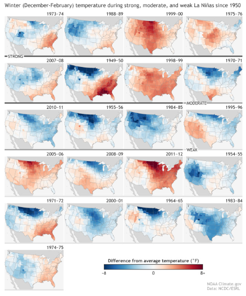
In the run-up to Winter '16 / '17 ... the leading analog was '08 / '09 followed by '51 / '52 ... '54 / '55 ... '74 / '75 ... and '11 / '12.  A qualitative assessment of the forecast's accuracy would rate the top four analog as 'poor' ... IOW ... useless.

Winter '08 / '09 NAO was negative to neutral trending positive into MAR; whereas Winter '16 / '17 was weakly positive trending moderate.  The closest analog ... on the basis of the NAO remaining positive throughout the three-month forecast period ... was ranked last ('11 / '12).

Conclusion:  Winter '16 / '17 NAO analogs showed little ... if any ... skill.

---
An alternative forecasting technique looks at the NAO's sign for any calendar-year's month preceding the pending winter as a potential leading indicator of the NAO's sign for D-J-F period.

Results from a chi-square 'test for independence' infers a statistically significant relationship ... at the 95% confidence level and a p-value < 0.05 ... between NOV's NAO sign and NAO's sign of the upcoming D-J-F period.  IOW ... if NOV's NAO is negative (positive) ... then the average NAO state during the upcoming winter will also be negative (positive); although the classification model is stronger ... i.e., lower false alarm rate ... for the predictor's month with a positive signs than negative.

Conclusion:  If NOV's NAO is positive ... chances are good the NAO state will average positive during the D-J-F period.

---
Period-of-record NAO data here.

Thursday, April 20, 2017

Winter '16 / '17 - 18th Annual 'Regular Season' Snowfall Forecast Contest: FINAL Results


Four contest-worthy storms this season.  Tied with Winter '05 / '06 for 15th place.
Under the ‘two-thirds’ rule … forecasters who entered at least THREE forecasts are included in this season's FINAL standings..

---
Top 5 Forecasts (Error statistic:  SUMSQ)
SUMSQ is the primary measure of forecaster skill (lower the better).
Accounts for the magnitude and distribution of the storm-total snowfall for all stations.

---
Top 5 Forecasts (Error statistic:  Total Absolute Error - TAE)
TAE is the secondary measure of forecaster skill (lower the better).
Accounts for the magnitude of snowfall at each station.

---
Top 5 Forecasts (Error statistic:  RSQ)
RSQ is a supplementary measure of forecaster skill (higher the better).
Accounts for how well the variability of the observed snowfall was accounted for by the forecast.


---
Average Z-scores for Forecasters who submitted entries for all four snow storms.

---
Winter '16 / '17 was only the third season without a JAN snow storm.
 
---
Hope to see y'all again next winter.

Saturday, April 08, 2017

Winter '16 / '17 - 18th Annual 'Regular Season' Snowfall Forecast Contest: The End is Nigh

Central Park ... NYC
19-FEB-41
Despite our longing for one more contest-worthy snow storm ... the long wave pattern shows little inclination to alter its ridiculously stubborn regime of processing 'all' SFC LOWs through the Great Lakes region.

Sure hasn/t been a great season for nor'easters in general or nor'easters climbing the coast from low latitudes specifically.

Most seasons ... it/s all said and done by early MAR.
Average date of the last 4" or greater snowfall:
CAR 23-MAR
BGR 15-MAR
PWM 08-MAR
ORH 07-MAR
BTV 06-MAR
CON 06-MAR
ALB 06-MAR
BGM 06-MAR
BOS 25-FEB
BDL 24-FEB

However ... there are exceptions.
Latest date of the last 4" or greater snowfall:
CAR 16-MAY
PWM 11-MAY
CON 10-MAY
ALB 10-MAY
ORH 09-MAY
BGR 24-APR
BTV 23-APR
BGM 22-APR
BDL 21-APR
BOS 10-APR

Source:
NOWData http://www.nws.noaa.gov/climate/index.php


The end of the Winter '16 / '17 snowfall forecasting season appears nigh.
All else equal ... the season will close on SAT ... 15-APR.

Sunday, April 02, 2017

Winter '16 / '17 - 16th Annual 'Season-total' Snowfall Forecast Contest: FINAL Results


Complete station-by-station forecaster verifications at the Contest/s web site here.

Two perfect forecasts
Donald Rosenfeld 100" @ CAR
Mitchel Volk 15" @ PHL

Near misses
Jessica_wxgirl 0.05" error @ RIC (7.2")
Shillelagh and Jessica_wxgirl 0.1" error @ MDT (23.9")
donsutherland1 0.1" error @ ORH (75.4")
MillVillWx 0.2" error @ ALB (58.3")
kevinmyatt 0.2" error @ NYC (30.2")
weathermbug ... TQ ... and DAROOSTA 0.2" error @ SBY (9.8")
Herb @MAWS and weathermbug 0.2" error @ ORF (5.4")
snowman 0.3" error @ BTV (91.7") and 0.2" error @ EWR (31.4")
Donald Rosenfeld 0.5" error @ BGM (104.5")


Season-total snowfall from all stations (1041") came in 14% above the period-of-record normal (914").  Winter '16 / '17 ranks 6th highest among other Contest years since winter '04 / '05 ... the season when BGR and BGM were added to the station list. 

Saturday, April 01, 2017

Winter '16 / '17 - Season-total Snowfall Forecast Contest: Observed Snowfall Station Summary

New England FTW!
 

Winter '16 / '17 - Season-total Snowfall Forecast Contest: MAR totals

Station snowfall summary for MAR-17.
Rank ordered by percent of monthly normal.


Station snowfall summary for Winter '16 / '17 - Season-to-date snowfall through MAR

Green ==> 75th percentile
White ==> 50th percentile
Red ==> 25th percentile
---
Teleconnection indexes and month-over trend (updated as they become available)
AO:  1.365⇧
NAO:  0.74⇩
PDO:  0.74⇧
QBO:  14.35⇩
SOI:  5.1⇧

---
⇩⇧⇔