Winter '09 / '10 - NHEMI Snowcover - October
NHEMI snow cover is above normal...a somewhat common phenomenon this decade. Recovery was rapid...after falling ~2% below normal seven or so days into the month.
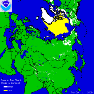
Snow cover anomaly is over land areas between 35°N and 55°N is currently +6%.
Good autumn snow cover over EURASIA plays an important role in defining winter's character. It perturbs the troposphere in such a way as to weaken the polar vortex (PV). Arctic air masses are better able to drain into lower latitudes when the PV is weak. The PV is also weaker when the QBO is east...as it will be this winter. More about EURASIAN snowcover/s predictive role in winter/s wx here.
Good autumn snow cover over EURASIA plays an important role in defining winter's character. It perturbs the troposphere in such a way as to weaken the polar vortex (PV). Arctic air masses are better able to drain into lower latitudes when the PV is weak. The PV is also weaker when the QBO is east...as it will be this winter. More about EURASIAN snowcover/s predictive role in winter/s wx here.


The combination of rich snow cover in EURASIA and QBO-east could provide the impetus for hi-latitude blocking and a persistently negative state of the northern annular oscillations known as the Arctic Oscillation and the North American Oscillation... which favors above-normal season-total snowfall in the NE and mid-Atlantic regions. +ENSO-related +PNA and an active lo-latitude / southern-tier storm track should provide ample opportunity for phasing and strong Miller-A cyclogenesis along the eastern seaboard.
More global snowcover charts @ FSU...NOAA...and Rutgers


No comments:
Post a Comment