Saturday, December 31, 2016

Winter '16 / '17 - Snow Storm #1: Preliminary Verification


Preliminary storm-total snowfalls for THU and FRI from CDUS41 and CXUS51 bulletins.  Good overall coverage.

---
One new daily record.
29-DEC-16
CON - 8.3" (7.1"; 1956)

---
Snow Storm #1 underperformed slightly with five stations reporting more than nuisance snowfall (>= 4").  BGM just couldn/t make it over the finish line.

A dozen stations reported snowfall greater than Trace.

No Snow-Liquid ratios for mixed precipitation conditions ... such as PWM ... where 1.84" liquid was measured.

---
Please report any errors in Comments along with a link to the correct data.

Final results NLT SUN evening.

Friday, December 30, 2016

Winter '16 / '17 - Snow Storm #1: New Daily Record Snowfall @ KCON

SFC:  00Z FRI ... 30-DEC-16
Concord ... NH (KCON) set a new daily snowfall record on 29-DEC-2016.

New record:  8.3" (12.2:1 SLR)
Old record:  7.1" (1956)

Light snow began falling over the station shortly before noon on the 29th ... turning heavy and increasing to an inch to an inch and one-half per hour between 5 and 8 PM EST.

Winter '16 / '17 - Snow Storm #1: TSSN


On-set of convection heralded the change from liquid to frozen precipitation.
---
KBED 300112Z 32011G19KT 1SM R11/6000VP6000FT -TSSN BR VV004 01/M01 A2941
RMK AO2 LTG DSNT SE AND S TSB06 P0001 T00061011

KBOS 300119Z 31015G25KT 3SM -TSSNGS SCT006 OVC015 01/01 A2938
RMK AO2 PK WND 32028/0056 RAE07SNB01GSB13 TSB10 LTGICCC W TS W MOV E P0007 T00110006

KPWM 300251Z 33013KT 1/2SM +TSSN FEW004 OVC010 M02/M02 A2929
RMK AO2 WSHFT 0154 RAE17SNB17 TSB49 PRESFR SLP918 LTGIC P0024 60079 I1002 I3002

K1P1 300255Z AUTO 00000KT 2 1/2SM -VCTSSN M03/M03 A2936 RMK AO2 P0001 60003 T10281031

Thursday, December 29, 2016

Winter '16 / '17 - Snow Storm #1: The Forecasts!

Rookie 0
Intern 0
Journey 0
Senior 8
Official 1
TOT 9
Included NWS 'official' forecasts ... as of the deadline.
---
Forecasts are ranked by their storm-total precipitation (STP).


BLUE ==> 25th percentile
RED ==> 75th percentile
Grey STP cells range between the 25th and 75th percentile.

---

Heaviest snowfall (>= 4") consensus along and the right of CAR - BGR - ORH - BGM - ALB - CON - CAR
Lollypop expected at CAR.

---

Teleconnection headwinds

---
Everyone/s station-by-station forecast post to NEWxSFC/s web site @ http://www.newx-forecasts.com/

Tuesday, December 27, 2016

Winter '16 / '17 - Snow Storm #1: Call for Forecasts!

Mill Pond ... ME
28-DEC-51
Borderline contest-worthy event relative to the number of forecast stations expected to observe more than nuisance accumulations given the SFC LOW/s progged proximity to the coast.

Today/s 12z NWP runs advertised rapid deepening of the SFC LOW along the SNE coast.  Strong UVM from dynamic cooling should cool columns enough to produce decent snows.

---
Forecast element: storm-total snowfall
Deadline:
10:30 PM EST ... WED... 28-DEC-16
Verification period begins:
12:01 AM EST ... THU ... 29-DEC-16
Verification period ends:
11:59 PM EST ... FRI ... 30-DEC-16
---
Enter your forecast at the NEWxSFC/s home page @ http://www.newx-forecasts.com/
Follow the top-of-page link from 'Enter Storm Forecast.'
---
As always ... there/s no cost ... no fee ... no advertising ... or annoying requests for personal information to enter a forecast.  It's just a fun exercise for winter wx enthusiasts to see who can make the best synoptic-scale snowfall forecast.
---
If you are issuing your first forecast this winter ... or you entered the 'season-total' forecast contest ... you/ll need to create an account (user name / password / valid e-mail ... if you want a copy of your forecast sent to your Inbox.
---
Contest may be cancelled before deadline if storm appears to fizzle.

Saturday, December 24, 2016

Winter '66 / '67 - White Christmas Eve

Classic Miller 'A'
Lived this one in SNJ :)

---
23-DEC
- Cyclogenesis ovr LA
- Rapid movement east along stalled Arctic boundary INVOF GOM states
- Full latitude trof just east of MS river

SFC:  23-DEC-66

 24 - DEC
- LOW on the SC coast
- Light pre-dawn snow begins over southern mid-Atlantic
+TSSN (thunder snow) @ PHL and ILG between 4 and 8 PM

SFC:  24-DEC-66
25-DEC
LOW occludes ovr Cape Cod

Select mid-Atlantic storm-total snowfall
PHL:  12.6"  (1.09 liquid; 11.5:1 SLR)
ACY:  6.5"
BWI:  8.4"
ILG:  12.4"
SFC:  25-DEC-66

5H:  23-DEC-66
 
5H:  25-DEC-66

Thursday, December 22, 2016

Winter '16 / '17 - Rare Snow in the African Desert

" ... snow on the edge of the Sahara Desert is rare. On December 19, 2016, snow fell on the Algerian town of Ain Sefra, which is sometimes referred to as the “gateway to the desert.”

"The town of roughly 35,000 people sits between the Atlas Mountains and the northern edge of the Sahara. The last recorded snowfall in Ain Sefra occurred in February 1979.

" ...  a review of several years of satellite data suggests that snow is also unusual in this section of the Saharan Atlas range.

"The snow fell in a region where summertime temperatures average 37°Celsius (99°Fahrenheit), though wintertime temperatures have been known to get down into the single digits Celsius (30s Fahrenheit). Such moisture is as rare as the cool temperatures, given that just a few centimeters (inches) of precipitation fall here in an entire year."

Source:  NASA Earth Observatory

Saturday, December 17, 2016

Winter '16 / '17 - Snow Storm #1: Near Miss

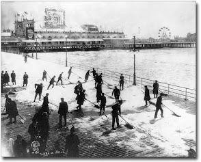
ACY Boardwalk (1928)
The season/s first snow storm out-performed not only the numerical models but the professional meteorologists responsible for issuing the official forecasts.

Heaviest significant snowfall (>= 4") at first-order reporting stations was observed along and either side of a line from CON - BOS - BDR - BDL - ORH - CON.  In addition to these five forecast points ... PWM at 3.6" and CAR at 3.5" ended up being close enough to have warranted a 'call for forecasts' and a contest-worthy snow storm had the writing been on the wall Thursday evening.  As it was ... NE snowstorm legend Paul Kocin painted a large swath of 40% probability for at least 4" on WPC/s afternoon package.
Models were late catching on to this storm/s potential.  Similar circumstances plagued last year/s contests ... as well.

---
Station / snowfall (")
BDL 6.5 (daily record)
ORH 6
BDR 5.3 (daily record)
CON 4.7
BOS 4.3
PWM 3.6
CAR 3.5
BGM 3.4
BGR 3.3
PVD 3.2
BTV ... ISP 3
EWR ... JFK 3 (daily records)
HYA 2.5 (est.)
ALB 2.4
ABE ... MDT ... PHL <1
ACY ... BWI ... IAD ... DCA T