Friday, March 30, 2018

Winter '17 / '18 - Coastal Teaser: #3

UPDATE:
SAT ... 31-MAR-18 @ 10 PM EDT

Nothing contest-worthy about this event ATTM.

Slightest chance the 00z ... 01-APR-18 NWP runs will suggest otherwise ==> possible SUN AM  'Call for Forecasts'.

---
Snow Storm #9?

Should the present NWP trend continue ...
Call for Forecasts:  SAT ... 31-MAR-18
Deadline for entries:  10:30 PM EDT ... SUN ... 01-APR-18
Verification period:  12:01 AM EST ... MON ... 02-APR-18 till TBD

Watch this space.

Wednesday, March 28, 2018

Winter '17 / '18 - Regular Season Interim Standings: 6

Under the ‘two-thirds’ rule … forecasters who have entered at least SIX forecasts are included in interim standings #6.

Complete interim statistics table and chart at the Contest/s web site here (direct link)
Forecaster statistics for Winter '17 / '18 contest snow storms here (direct link)

 ---
SUMSQ errors for each contest snow storm are normalized (standardized) with a 'Z-score' ... then averaged to compute the standings. If a forecaster has issued forecasts for more than two-thirds of all snow storm contests ... then Z-scores from their 'best two-thirds' forecasts are used to calculate the Interim and Final standings.

Similar idea as dropping the lowest quiz score before computing the final grade.

Saturday, March 24, 2018

Winter '17 / '18 - Snow Storm #8: FINAL Results

Forecasters' station verifications and the storm summary at NEWxSFC/s home page.
http://www.newx-forecasts.com/

     
 1st - Brad Yehl   
 SUMSQ:278  
 SUMSQ Z:-1.279  
 STP:28.9 (3) 
 TAE:65.1 (1) 
 AAE:2.50 (1) 
     
 2nd - Shillelagh   
 SUMSQ:380  
 SUMSQ Z:-0.845  
 STP:43.4 (5) 
 TAE:73.7 (2) 
 AAE:2.95 (2) 
     
 3rd - donsutherland1   
 SUMSQ:483  
 SUMSQ Z:-0.408  
 STP:64.9 (9) 
 TAE:90.3 (5) 
 AAE:3.34 (4) 
     
 HM - iralibov   
 SUMSQ:489  
 SUMSQ Z:-0.383  
 STP:60.1 (7) 
 TAE:87.3 (3) 
 AAE:3.23 (3) 
     

SUMSQ:  sum of square error (")
SUMSQ Z:  Z-score
STP:  storm total precipitation error (")
TAE:  total absolute error (")
AAE:  average absolute error (")
(#):  category rank

Forecast by Observed Snowfall Scatterplots for Top Forecasts
Dotted blue line below (above) solid red line ==> under (over) forecast

Station by Station Comparison of Top Forecasters

Friday, March 23, 2018

Winter '17 / '18 - Snow Storm #8: Preliminary STP Verifications

Table of preliminary storm-total snowfall by station for WED and THU from CDUS41 (CLI) ... CXUS51 (CF6) and ... SAUS41 (METAR) bulletins.

Exceptions:  none

SLR not available for some stations reporting measureable snowfall b/c liquid and / or freezing precipitation also occurred during the verification period.

---
Stations observing at least Trace - 24 (89%) [corrected]

Given a forecast station observed measurable snowfall ...
Stations observing at least:
4" - 10 (42%)
8" - 5 (21%)
12" - 2 (8%)
16" - 1 (4)

Melt-water
ISP - 1.28"
MDT - 1.13"
PHL - 1.03"
JFK - 0.91"

Max precipitation:  ISP - 1.28"

New daily records:
21-MAR-18 (7)
ISP - 14" (1.8"; 2013)
ABE - 13.2" (4.3"; 1964)
MDT - 11.9" (7.5"; 1964)
JFK - 8.4" (0.8"; 1993)
EWR - 7.9" (5.3"; 1958)
PHL - 6.7" (4.7"; 1932)
IAD - 4.8" (2.3"; 1964)

22-MAR-18 (1)
ISP - 4.4" (3"; 1992)

SFC analysis:  03z ... 22-MAR-18

METAR KISP 220256Z 01017G28KT 1/8SM R06/2000V3000FT +SN FG VV003 00/00 A2964 RMK
AO2 PK WND 03033/0231 SLP036 ==> SNINCR 5/12 <== P0023 60040 T00000000 51001 =

5" / hour!

---
Please report errors in Comments along with a link to the correct data.
FINAL Results post expected SAT evening ... 24-MAR-18

Wednesday, March 21, 2018

Winter '17 / '18 - Regular Season Interim Standings: 5

Under the ‘two-thirds’ rule … forecasters who have entered at least FIVE forecasts are included in the interim standings.

Complete interim statistics table and chart at the Contest/s web site here (direct link)
Forecaster statistics for Winter '17 / '18 contest snow storms here (direct link)

---
SUMSQ errors for each contest snow storm are normalized (standardized) with a 'Z-score' ... then averaged to compute the standings. If a forecaster has issued forecasts for more than two-thirds of all snow storm contests ... then Z-scores from their 'best two-thirds' forecasts are used to calculate the Interim and Final standings.

Similar idea as dropping the lowest quiz score before computing the final grade.

Winter '17 / '18 - Snow Storm #8: The Forecasts!

Rookie    -
Intern    1
Journey    -
Senior    12
GOVT    1
PWSP    -
TOT  14

All forecasts posted to the Contest/s web site. (direct link)

Forecasts ranked by their verification period storm-total precipitation (STP).
BLUE = 25th percentile
RED >= 75th percentile
White STP and 4cast cells range between the 25th and 75th percentile

NWS ER WFOs (GOVT) forecasts derived from public issuances current at the deadline.

Heaviest snowfall (>= 10") consensus along and to the right of PHL - EWR - BDR - ISP - JFK - PHL .  Snow cone expected at EWR.

AO regime change with a cursory assist by the NAO.

Tuesday, March 20, 2018

Winter '17 / '18 - Snow Storm #8: RAW FORECASTS

Here

Winter '17 / '18 - Snow Storm #8: Front-end +TSSN

Blacksburg ... VA
INVOF Roanoke (ROA)

METAR KBCB 210135Z AUTO 05007KT 1/2SM +VCTSSN OVC006 00/00 A2959 RMK AO2 LTG DSNT SE

Monday, March 19, 2018

Winter '17 / '18 - Snow Storm #8: Call for Forecasts!

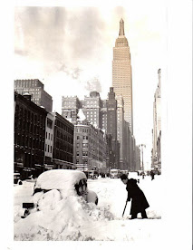
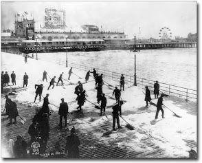
19-MAR-56
Carmine St ... NYC
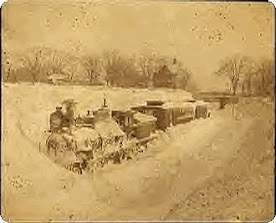
Not the 1st time the progs indicated an out to sea solution in the medium range ... then hang a hard left and roar up the coast as its VT approaches.

Should Snow Storm #8 come to pass ... MAR will have at least three contest-worthy snow storms for only the third time in NEWxSFC/s history.

Other years with three MAR snow storms happened in 2001 and 2014 (return period 9.5 years; probability during any given winter:  11%). 

The forecast contest for Snow Storm #8 may be cancelled prior to the deadline if fewer than six stations are likely to observe at least a 4" snowfall.

---
Forecast element:  each station's verification period snowfall

Deadline for entries:  10:30 PM EDT ... TUE ... 20-MAR-18
Verification period begins:  12:01 AM EDT ... WED ... 21-MAR-18
Verification period ends:  11:59 PM EDT ... THU ... 22-MAR-18

---
Enter your forecast at the NEWxSFC/s home page here.  http://www.newx-forecasts.com/
Follow the top-of-page link from 'Enter Storm Forecast.

---
As always ... there/s no cost ... no fee ... no advertising ... or annoying requests for personal information to enter a forecast.  It's just a fun exercise for winter wx enthusiasts to see who can make the best synoptic-scale snowfall forecast.  See how well your forecast stacks up against NWS Eastern Region Weather Forecast Offices.

---
 If you are issuing your first forecast this winter ... or you entered the 'season-total' forecast contest ... you/ll need to create an account (user name / password / valid e-mail ... if you want a copy of your forecast sent to your Inbox).


NEWxSFC/s email client is permanently off-line.
Forecasters may no longer have a copy of their forecast emailed to them.
Some are getting thorugh.  Some are not.
The Contest/s email address newx (at) newx-forecasts (dot) com remains unreachable.
Apologies for the degraded service which is beyond my control.

Saturday, March 17, 2018

Winter '17 / '18 - Snow Storm #7: FINAL Results

Forecasters' station verifications and the storm summary at NEWxSFC/s home page.
http://www.newx-forecasts.com/

     
 1st - iralibov   
 SUMSQ:328  
 SUMSQ Z:-1.379  
 STP:31.6 (5) 
 TAE:66.3 (1) 
 AAE:2.46 (1) 
     
 2nd - donsutherland1   
 SUMSQ:365  
 SUMSQ Z:-1.041  
 STP:29.7 (2) 
 TAE:67.0 (2) 
 AAE:2.48 (2) 
     
 3rd - TQ   
 SUMSQ:394  
 SUMSQ Z:-0.787  
 STP:47.5 (8) 
 TAE:75.0 (4) 
 AAE:2.78 (4) 
     
 HM - Brad Yehl   
 SUMSQ:400  
 SUMSQ Z:-0.735  
 STP:45.8 (7) 
 TAE:67.8 (3) 
 AAE:2.51 (3) 
     

SUMSQ:  sum of square errors (")
SUMSQ Z:  Z-score
STP:  storm total precipitation error (")
TAE:  total absolute error (")
AAE:  average absolute error (")
(#):  category rank

Forecast by Observed Snowfall Scatterplots for Top Forecasts
Dotted blue line below (above) solid red line ==> under (over) forecast

Snowfall analysis courtesy National Operational Hydrologic Remote Sensing Center
http://www.nohrsc.noaa.gov/interactive/html/map.html

Friday, March 16, 2018

Winter '17 / '18 - Snow Storm #7: Preliminary STP Verifications

Table of preliminary storm-total snowfall by station for WED and THU from CDUS41 (CLI) ... CXUS51 (CF6) and ... SAUS41 (METAR) bulletins.

Exceptions:  none

SLR not available for some stations reporting measureable snowfall b/c liquid and / or freezing precipitation also occurred during the verification period.

---
Stations observing at least:
Trace - 27 (100%)
4" - 14 (52%)
8" - 10 (37%)
12" - 6 (22%)
16" - 3 (11)
20" - 2 (7%)

Melt-water
ORH - 1.6"
PWM - 1.28"
BTV - 1.19"
BGR, BOS - 1.16"

Max precipitation:  ORH - 1.6"

New daily records:  13-MAR-18
ORH - 21.8" (14.8"; 1993)
BOS - 14.5" (12.3"; 1993)
PVD - 9.5"  (7"; 1993)

SFC analysis:  15z ... 13-MAR-18

13-MAR-93:  the last Storm of the Century for the 20th century.

---
Please report errors in Comments along with a link to the correct data.
FINAL Results post expected SAT evening ... 17-MAR-18

Thursday, March 15, 2018

Winter '17 / '18 - Regular Season Interim Standings: 4


Under the ‘two-thirds’ rule … forecasters who have entered at least FOUR forecasts are included in the interim standings.

Complete interim statistics table and chart at the Contest/s web site here (direct link)
Forecaster statistics for Winter '17 / '18 contest snow storms here (direct link)

---
SUMSQ errors for each contest snow storm are normalized (standardized) with a 'Z-score' ... then averaged to compute the standings. If a forecaster has issued forecasts for more than two-thirds of all snow storm contests ... then Z-scores from their 'best two-thirds' forecasts are used to calculate the Interim and Final standings.

Same idea as dropping the lowest quiz score before computing the final grade.