Thursday, December 31, 2015

Winter '15 / '16 - Snowfall Totals (29-DEC-15)

Snowfall totals for the almost contest-worthy event of 29-DEC-15.

PWM  7.0"
BGR  6.9"
CAR  5.3"
BTV  5.1"
CON  4.2"
ORH  1.4"
ALB  1.3"
BDL  1.0"
BOS  0.9"
BDR  0.7"
BGM  0.6"
PVD  0.6"
EWR  T
ISP  T
JFK  T

DEC goes into the books without a contest-worthy storm for the second year in a row.

Three quarters left in the season.
Bring on the pattern change!


Friday, December 25, 2015

Winter '15 / '16 - Coastal Teaser #1


Maybe DEC 2015 won't go into the record books as not having a single contest-worthy snow storm.

Progs depict weak cyclogenesis this weekend over southern TX and a track to the NE well west of the Appalachian mountains with half-hearted secondary development off the Delmarva a few days later.

Retreating and weakening Arctic HIGH over SE CN would support a layer a slop along the coast with plowable snows inland.

NWP image courtesy meteocentre.com

---
NEWxSFC's historian reports four of 16 DECs without a contest-worthy storm (winters ending:  '00, '07, '12, '15).


Season-total snowfall totals ... P-O-R-N ... and PCT of P-O-R-N
'99 - '00 (unavailable - no season-total contest)
'06 - '07   617" / 926" (67%)
'11 - '12   393" / 934" (42%)
'14 - '15  1,336" / 934" (143%)

Not a good sign but too soon to abandon all hope.

Sunday, December 20, 2015

Winter '15 / '16 - Sudden Stratospheric Warming: Watch #1 UPDATE 1

ECMWF continues to signal PV weakening near month's end.

Initial panel (right) @ 80 m/s (155 knot; 179 mph).

D+10  @ 60 m/s (117 knot;134 mph).Also note the weakening +QBO feature INVOF 30 mb.

00 mb D+10 prog (bottom) signals the start of a splitting PV with circulation centers over the Laptev Sea (west of Barents Sea) and extreme northern Canada ... as well as the leading edge of a sharp wave over the Prime Meridian.

Takes a few weeks for a propagating wave to reach 10 mb then work its way to the surface.


Monday, December 14, 2015

Winter '15 / '16 - Sudden Stratospheric Warming: Watch #1

Following a recent cross-hemisphere shift of the polar vortex's (PV) center of circulation from NW Greenland to the Barents Sea ... the first signs of upward propagating wave energy have appeared on the ECMWF/s 13-DEC-15 100 / 70 / 50 mb progs.

The potential for a PV split faces a stiff headwind.  The quasi-biennial oscillation (QBO) began it westerly phase in JUN and has yet to reach its peak suggesting the PV stays intact.

Of course ... if a SSW comes to fruition ... it takes time for the initial wave to reach 10 mb and then propagate to the surface on average about three weeks later making the 'if and when' of it all wait until late JAN.

Tuesday, December 1, 2015

Winter '15 / '16 - 15th Annual 'Season-total' Snowfall Forecast Contest - The Forecasts

14 forecasters + P-O-R-N + CONSENSUS
375 station forecasts


Entries ranked by STP
BLUE - 25th percentile
RED - 75th percentile
ORANGE - Winter '14 / '15 Top Season-total forecaster
P-O-R-N - period of record normal
CONSENSUS - average of individual forecasts by station

---
Station forecasts for BELOW average snowfall - 160 (43%)
Station forecasts for ABOVE average snowfall - 215 (57%)

Consensus (at least 67% of forecasts) for stations w/BELOW average snowfall @ BGM
Consensus (at least 67% of forecasts) for stations w/ABOVE average snowfall @ CAR ... BTV ... PVD ... BDR ... ABE ... BWI ... IAD ... and DCA

---
 
---
All station forecasts at the Contest/s web site here.
 
The regular 'snow storm' forecasting contest begins when the flakes start flyin'.
'Call for Forecasts' are issued at NEWxSFC/s web log here ... via e-mail ... and Facebook.

Saturday, October 31, 2015

Winter '15 / '16 - 15th Annual 'Season-total' Snowfall Forecast Contest - Call for Forecasts!

NE.Wx's 15th annual ‘Season-total' Snowfall Forecast Contest is the absolute best ... biggest ... and probably ONLY chance to be recognized for your long-range forecasting acumen.

And it's easy.
All you have to do is forecast the season-total snowfall at 25 stations from RDU to CAR!

Deadline: MON ... 30-NOV-15 @ 11:59 PM EST

---
Visit the Contest's website to enter your forecast.
Follow the link at the top of the page to 'Enter Season-total Forecast.'

1st place prize (delivered post-paid right to your front door):
"The Snow Booklet" by Nolan J. Doesken and Arthur Judson (paperback and .pdf) and "Snow in America" by Bernard Mergan (hardcover)

---
As always ... NO cost ... NO fees ... NO advertising ... NO annoying requests for personal information to enter the contest.  NEWxSFC is just a fun exercise for winter wx enthusiasts to see who can make the best season-total snowfall forecast.

---
Forecast element: sum-total season snowfall @ each station
Forecast period: 01-DEC-15 through 31-MAR-16
Verification: NWS preliminary climate reports (CLM or CF6)

Error statistic: total absolute error [Σ abs(forecast - observed)]

Update your forecast as often as you want prior to the deadline.
Only your last entry gets verified.

---
The reigning NE.Wx ‘Season-Total’ Snowfall Forecasting Champ-een is Don Sutherland.
Last year's 'Season-total' forecast summary ... verification ... and final results ==> here.

---
The Contest is open to amateur and professional forecasters; broadcasters with or without trained Seals; any and all weather-biz types and / or wanna-bees; wish-casters ... astrologers ... along with any other universally recognized classes of dreamers; Pollyannas or Cassandras ... registered Nostradamusts ... non-violent megalomaniacs ... woolly-bear caterpillars or their agents ... pest detectives ... NE.Wx NG veterans and lurkers; refugees from AmericanWx and/or USWeather ... including self-imposed exiles from Eastern Wx ... and of course ... meteorologists.

In honor of USENET/s ne.weather's patron saint Mr. Joseph Bartlo's final request (RIP) ... trolls ... goats ... hat3-lsiters ... and psests need not apply.

Monday, May 4, 2015

Winter '14 / '15 - PDO: Variability Since 1661 CE

ABSTRACT:
"Climate in the North Pacific and North American sectors has experienced interdecadal shifts during the 20th century. A network of recently developed tree-ring chronologies for Southern and Baja California extends the instrumental record, and reveals decadal-scale variability back to AD 1661.


"The Pacific Decadal Oscillation (PDO) is closely matched by the dominant mode of tree-ring variability, which provides a preliminary view of multi-annual climate fluctuations spanning the past four centuries. The reconstructed PDO index features a prominent bidecadal oscillation, whose amplitude weakened in the late 1700s to mid-1800s.

"A comparison with proxy records of ENSO suggests that the greatest decadal-scale oscillations in Pacific climate between 1706 and 1977 occurred around 1750, 1905, and 1947."


"Reconstructed PDO since 1660.
Correlation between instrumental (dashed) and reconstructed PDO is 0.64 from 1925 to 1991.

"During warm periods, the eastern North Pacific is warmer than usual, and the central North Pacific
is cooler (viceversa during cool periods). Warm and cool PDO phases are qualitatively similar to warm
and cool ENSO events, but different because of slower temporal dynamics and stronger midlatitudinal responses."

More...

Winter '14 / '15 - Storm #7: NESIS

NESIS

Thursday, April 9, 2015

Winter '14 / '15 - Above Normal Snowfall and the MIA Northern Annular Oscillations

NYC
13-DEC-60

Number of days between 01-DEC and 31-MAR:  121
Number of days between 01-DEC and 31-MAR where

NAO <= 0:  9
NAO <= -1:  0

NAO >= 1:  50
NAO >= 1.5:  18
NAO >= 2:  2

AO <= 0:  28
AO <= -1:  9
AO <= -1.5:  2

AO >= 1:  60
AO >= 1.5:  48
AO >= 2:  32
AO >= 3:  11
AO >= 4:  4
AO >= 5:  3

PNA >= 0:  85
PNA >= 1:  11
PNA >= 1.5:  0

Number of NEWxSFC stations with at least
100% normal snowfall:  22
150% normal snowfall:  9
200% normal snowfall:  3
250% normal snowfall:  1


AO - NAO - PNA (daily)
Meteorological winter '14 / '15
AO - NAO - PNA (7-day moving average)
Meteorological winter '14 / '15
AO - NAO - PNA (30-day moving average)
Meteorological winter '14 / '15

---
Something happenin' here.
What it is ain't exactly clear.

Wednesday, April 8, 2015

Winter '14 / '15 - 14th Annual Season-total Snowfall Forecast Contest: FINAL Results

Don Sutherland FTW!

 
The 'season-total' snowfall forecast contest/s error statistic is total absolute error.
For each forecast station ... the absolute value of (Forecast - Observed) is calculated ... then summed.
 
Forecasts with lower 'total absolute forecast' errors have more skill than those with higher 'total absolute forecast' errors.
 
P-O-R-N is the 'Period Of Record Normal' or climatology.
Skillful season-total forecasts beat climatology.
 
---
Lowest Station Errors
 
Forecaster STP Summary
 
Snowfall Totals (DJFM)
 
DEC Totals
 
JAN Totals
 
FEB Totals
 
MAR Totals
 
---
Everyone's forecast has been verified and posted to the Contest/s web site here.
Hope to see y'all back again next winter.

Winter '14 / '15 - Season-total Snowfall Forecast Contest: Lowest Station Errors


Winter '14 / '15 - Season-total Snowfall Forecast Contest: Forecaster STP Summary

Forecaster season-total snowfall forecasts are ranked by their departure from the observed season-total snowfall.  It does not show forecasts ranked by their accuracy.  Forecast accuracy is determined by the sum of absolute errors for all stations.

Red ==> 67th percentile
White ==> Less than 75th and greater than 25th percentile
Blue ==> 33rd percentile

Winter '14 / '15 - Season-total Snowfall Forecast Contest: Snowfall Totals (DJFM)

Despite the slow start to the season ... winter quickly made up for lost time between late JAN and MAR.
Season-total snowfall for all stations (1,336") came in 43% above the period-of-record normal (934"). 
 
 
Green ==> 75th percentile
White ==> Less than 75th and greater than 25th percentile
Red ==> 25th percentile

---
 
---
STP for winter '14 / '15 ranks 3rd among other Contest years since winter '04 / '05 ... the season when BGR and BGM were added to the station list.
 

Winter '14 / '15 - Season-total Snowfall Forecast Contest: MAR Totals

Monthly station snowfall summary for MAR-15.
Rank ordered by percent of monthly normal.


Green ==> 75th percentile
White ==> Less than 75th and greater than 25th percentile
Red ==> 25th percentile
 
---
Teleconnection Indexes
AO:  +1.837
NAO:  +1.45
PNA:  +0.49
PDO:  2.00
QBO:  -28.15 (monthly record)
MEI:  .650 (FEB-MAR)

Saturday, March 28, 2015

Winter '14 / '15 - Sudden Stratospheric Warming: Watch #2 - Update 4

Incoming!

 
Deep layer Easter easterlies.
 
 
PV displacement
 
Split vortices.
 
---
Major SSW event has begun!


Wednesday, March 25, 2015

Winter '14 / '15 - Sudden Stratospheric Warming: Watch #2 - Update 3

ECMWF continues its forecast for a SSW event in the near-term.

Monday, March 23, 2015

Winter '14 / '15 - Sudden Stratospheric Warming: Watch #2 - Update 2

Complete break down of the Polar vortex at month's end.
Deep ... deep layer wind reversal (easterlies up and down the Polar atmosphere) 
 

Prediction:  cold spring in the east.

Tuesday, March 17, 2015

Winter '14 / '15 - Sudden Stratospheric Warming: Watch #2

ECMWF predicts a reversal by displacement of the Polar vortex beginning 24-MAR-15 ...


... and a deep ... icy trough INVOF Baffin Bay.
 
mid-to-late April could turn out quite interesting.

Wednesday, March 11, 2015

Winter '14 / '15 - Season-total Snowfall Forecast Contest: FEB Totals

Monthly station snowfall summary for FEB-15.
Rank ordered by percent of monthly normal.


Green ==> 75th percentile
White ==> Less than 75th and greater than 25th percentile
Red ==> 25th percentile
 
---
Teleconnection Indexes
AO:  +1.043
NAO:  +1.32
PNA:  +0.49
PDO:  +2.30 (monthly record)
QBO:  -28.62 (monthly record)
MEI:  +0.468 (JAN-FEB)

Monday, March 9, 2015

Winter '14 / '15 - Interim Standings: 5

Under the ‘two-thirds’ rule … forecasters who have entered at least FIVE forecasts are included in these interim standings.


---
Complete interim statistics table and charts at the Contest/s web site here.
All verified forecast statistics from all forecasters for all Winter '14 / '15 contest storms here.

---
SUMSQ errors for each contest snow storm are normalized with a 'Z-score' ... then averaged to compute the standings.

If a forecaster has issued forecasts for more than two-thirds of all snow storm contests ... then Z-scores from their 'best two-thirds' forecasts are used to calculate the Interim and Final standings. Same idea as dropping the lowest quiz score before computing the final grade.

Saturday, March 7, 2015

Winter '14 / '15 - Storm #7: FINAL Results

Full forecast verifications and summary for Storm #7 at the Contest/s web site.

     
 1st - Brad Yehl 
 SUMSQ:58.98  
 SUMSQ Z:-0.763  
 STP:14.3 (4) 
 TAE:24.8 (1) 
 AAE:1.08 (1) 
     
 2nd - Herb@MAWS 
 SUMSQ:69.13  
 SUMSQ Z:-0.689  
 STP:15.1 (7) 
 TAE:27.9 (2) 
 AAE:1.27 (3) 
     
 3rd - donsutherland1 
 SUMSQ:71.2  
 SUMSQ Z:-0.674  
 STP:8.0 (1) 
 TAE:30.6 (4) 
 AAE:1.22 (2) 
     
 HM - Donald Rosenfeld 
 SUMSQ:81.4  
 SUMSQ Z:-0.599  
 STP:18.9 (8) 
 TAE:28.2 (3) 
 AAE:1.28 (4) 
     

SUMSQ: sum of square errors
STP: storm-total precipitation error
TAE: total absolute error
AAE: average absolute error
(number): category rank

---


---
Click images to enlarge.

Friday, March 6, 2015

Winter '14 / '15 - Storm #7: Preliminary Verification

Preliminary storm-total snowfalls for THU from CDUS41 and CXUS51 bulletins.

Good coverage and reporting.

SBY/s STP interpolated from PNSAKQ vicinity reports.

---
Six new daily snowfall records
THU ... 05-MAR-15
IAD - 9.5" (1.0"; 2001)
ACY - 7.0" (0.3"; 1960)
PVD - 6.3" (3.8"; 1931)
ISP - 6.3" (1.0"; 1993)
DCA - 4.8" (4.4"; 1888)
BDR - 4.0" (1.3"; 1981)

Record daily precipitation at ACY (2.4")

---
Please report any errors in Comments along with a link to the correct data.

Final results SAT evening.

Thursday, March 5, 2015

Winter '14 / '15 - Storm #7: The Forecasts!

Rookie 0
Intern 1
Journey 1
Senior 9
TOT 11


Forecasts are ranked by their storm-total precipitation (STP).

BLUE ==> 25th percentile.
RED ==> 75th percentile.
STP cells without color are between the 25th and 75th percentile.

---

Heaviest snowfall (+6") consensus along and to the right of a line from PHL - ACY - DCA - IAD - BWI - PHL

---

Opposite day.

 ---
 Everyone/s station-by-station forecast at the Contest/s web site.

Tuesday, March 3, 2015

Winter '14 / '15 - Storm #7: Call for Forecasts!

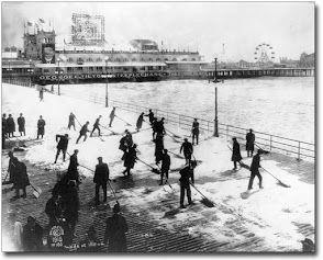
ACY Boardwalk - 1928
Pattern change may be coming but not before  there's another contest-worthy snow storm. 

Real mess of mixed precipitation types and Arctic temperatures in the offing will make for a challenging late-season forecast.

Contest for Storm #7 may be cancelled prior to the deadline if fewer than six stations are likely to observe at least a 4" snowfall.

---
Forecast element: storm-total snowfall
Deadline for entries:  10:30 PM EST ... WED ... 04-MAR-15

Verification begins:  12:01 AM EST ... THU ... 05-MAR-15
Verification ends:  when the snow stops falling

---
Enter your forecast at the NEWxSFC/s home page here.

Follow the top-of-page link from 'Enter Storm Forecast.

---
As always ... there/s no cost ... no fee ... no advertising ... or annoying requests for personal information to enter a forecast.  It's just a fun exercise for winter wx enthusiasts to see who can make the best synoptic-scale snowfall forecast.

---
If you are issuing your first forecast this winter...or you entered the 'season-total' forecast contest ... you/ll need to create an account (user name / password / valid e-mail ... if you want a copy of your forecast sent to your Inbox).

Wednesday, February 25, 2015

Winter '14 / '15 - Ice Rings Manhattan Island

Brooklyn Bridge
AP Photo/Seth Wenig