Thursday, January 31, 2019

Winter '18 / '19 - Snow Storm #3: Preliminary STP Verification

Preliminary storm-total snowfalls for TUE and WED from CDUS41 (CLI) ... CXUS51 (CF6) ... and PNS bulletins.

Good coverage and reporting with exceptions at BDR and MDT.

BDR
No snowfall report carried in 30-JAN CLI or F6 bulletins.
METARs reported brief burst of heavy snow with late-day Arctic FROPA.
JFK and ISP observed 0.2" around the same time.
Final STP may be revised from reported value if update issued by WFO OKX.

MDT
No snowfall report carried in 30-JAN CLI or F6 bulletins.
METARs reported brief period of moderate snow with mid-day Arctic FROPA.
Final STP may be revised from reported value if update issued by WFO CTP.

HYA
Trace STP based on METAR analysis and the lack of spotter reports in PNSBOX.

---
Stations observing at least Trace - 24 (89%)
Given stations having a measurable snowfall ... stations observing at least:
4" - 8 (33%)
6" - 2 (8%)
8" - 0 (0%)

No new daily records


Image courtesy NOHRSC

SFC analysis:  06z ... 30-JAN-19

Please report any errors in Comments along with a link to the correct data.
FINAL results NLT SAT evening.

Tuesday, January 29, 2019

Winter '18 / '19 - Snow Storm #3: The Forecasts!

Rookie  1
Intern  -
Journey  1
Senior  10
GOVT  1
PWSP  -
TOT  13

Welcome Rookie forecaster Hollowman501
Good Luck!

Forecaster table ranked ascending by storm-total precipitation (STP)
Correction:  The forecaster class for JessicaCain should be 'Journeyman.'

BLUE ==> 25th percentile.
RED ==> 75th percentile.
WHITE and GREY STP cells range between the 25th and 75th percentile.

Heaviest snowfall (+6") consensus along and to the right of CAR - BGR - CON - ALB - BTV - CAR.  Lollypop expected at CAR.

Arctic Oscillation (AO) lurking just beneath the surface.
North Atlantic Oscillation (NAO) floating high above the fray (again).
Pacific-North American (PNA) flattening out.

Everyone/s station-by-station forecast at the Contest/s web site.
Direct link to the forecasts table.

Sunday, January 27, 2019

Winter '18 / '19 - Snow Storm #3: Call for Forecasts!

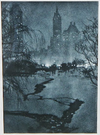
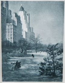
Conservatory Lake - Central Park - NYC (10-FEB-34)
Clipper-type short wave progged to dive SE across north-central CONUS on MON ... then re-develop off the SNE coast TUE ... may turn out to be 'contest-worthy.'

Numerical weather prediction models sometimes don't converge on a consensus solution and don't show systems like this their 'game face' until ~24 hours before flakes start flyin' for real.

Seeing how there have been so few chances to forecast storm-total snowfall this winter ... we're issuing a 'Call for Forecasts' for Snow Storm #3.

The contest for Snow Storm #3 may be cancelled prior to the deadline if fewer than six stations are likely to observe at least a 4" storm-total snowfall.
.
---
Forecast element: each station's storm-total snowfall
Deadline for entries: 10:00 PM EST ... MON ... 28-JAN-19
Verification begins: 12:01 AM EST ... TUE ... 29-JAN-19
Verification ends: 11:59 PM EST ... WED ... 30-JAN-19
.
---
Enter your forecast at the NEWxSFC/s home page here. http://www.newx-forecasts.com/
Follow the top-of-page link from 'Enter Storm Forecast.
.
---
As always ... there/s no cost ... no fee ... no advertising ... or annoying requests for personal information to enter a forecast. It's just a fun exercise for winter wx enthusiasts to see who can make the best synoptic-scale snowfall forecast.

You also get the chance to see how well your forecast stacks up against NWS Eastern Region Weather Forecast Offices (turns out they're pretty easy to beat!)
.
---
If you are issuing your first forecast this winter ... or you entered the 'season-total' forecast contest ... you/ll need to create an account -- user name / password / valid e-mail (if you want a copy of your forecast sent to your Inbox).

Saturday, January 26, 2019

Winter '18 / '19 - We're the Heckawi

Mid-Atlantic winter wx enthusiasts couldn't ask for better synoptics than the current long wave flow regime.

- High amplitude ridge to the West.
- Full latitude trof in the East.
- Sub-tropical jet in a split flow
- Split stratospheric polar vortex with the stronger daughter vortice over eastern North America to boot.

So WTF?
If times be so good ... then bro ... where's my fookin' snow?

Us snow crows nesting here in the eastern half of the mid-Atlantic will most often get our winter wx fix when ...
1) LOW pressure spawns over the Gulf of Mexico & proceeds to crawl slowly up the east coast and

2) A strong Arctic HIGH (1040-ish mb; 30.70" Hg) parks herself over Maine and

3) The wavelength between the Ridge-West / Trof-East pattern contracts i.e., becomes shorter.  As the wavelength shortens ... storms spin-up (intensify) the same way ice skaters spin-up when when they draw their arms inward (see  Conservation of Angular Momentum)

Wicked winter wx 'round here has always been a tricky combination of having a deep layer of Arctic / Polar air in place ... ready to interact with moisture surging from the south.

The current long wave flow regime is certainly delivering in spades with the cold air component; however ... it's coming on too strong ... in effect suppressing moisture from coming north.

FWIW ... the world-wide federation of numerical weather prediction (NWP) models have been tilting toward an adjustment to the long wave pattern in mid-range; a shuffling of the deck so to speak (more like re-setting the tumblers in a one-armed bandit).

Climatologically for snow crows ... FEB is our time 'round here ... especially the period either side of mid-month.  Whether the coming pattern change produces the weather we be waiting for is anyone's guess.

Even though long-range NWP offers us nothing more than possible outcomes ... outcomes more often fantasy than fact ... it's one of those j'ne sais WTF reasons why we all be Weather Weenies.

---


Friday, January 25, 2019

Tuesday, January 22, 2019

Winter '18 / '19 - Snow Storm #2: FINAL Results

Forecasters' station verifications and the storm summary at NEWxSFC/s home page.
http://www.newx-forecasts.com/

1st - TQ  
SUMSQ: 219
SUMSQ Z: -0.950
STP: 38.0  (4)
TAE: 46.6  (2)
AAE: 2.12  (1)
2nd - HWSNBN
SUMSQ: 233
SUMSQ Z: -0.914
STP: 25.9  (3)
TAE: 45.5  (1)
AAE: 2.53  (3)
3rd - Shillelagh  
SUMSQ: 280
SUMSQ Z: -0.792
STP: 50.4  (5)
TAE: 56.4  (3)
AAE: 2.97  (5)
HM - Roger Smith  
SUMSQ: 349
SUMSQ Z: -0.612
STP: 9.6  (1)
TAE: 62.6  (5)
AAE: 2.32  (2)
SUMSQ:  sum of square error (")
SUMSQ Z:  Z-score
STP:  storm total precipitation error (")
TAE:  total absolute error (")
AAE:  average absolute error (")
(#):  category rank

Forecast by Observed Snowfall Scatterplots for Top Forecasts
Dotted blue line below (above) solid red line ==> under (over) forecast

Station by Station Comparison of Top Forecasters

Monday, January 21, 2019

Winter '18 / '19 - Areal Snow Cover: Season-to-Date


Image courtesy National Operational Hydrologic Remote Sensing Center (NOHRSC)

Winter '18 / '19 - Snow Storm #2: Preliminary STP Verification

Preliminary verification of storm-total snowfalls for Saturday & Sunday from CDUS41 ... CXUS51 ... and PNS bulletins.

Less than perfect coverage and reporting.
ABE 2.4" snowfall observed SAT.
No daily climate report for SUN/s snowfall.
METARs reported no frozen precipitation on SUN.

HYA storm-total snowfall estimated by inverse distance weighting of vicinity reports carried in BOX PNS.

---
Stations observing at least Trace - 17 (63%)

Given a forecast station observed measurable snowfall ... stations observing at least:
4" - 9 (53%)
6" - 7 (41%)
8" - 5 (29%)
12" - 4 (24%)
14" - 2 (12%)

Two new daily records
SUN ... 20-JAN-19
BTV - 15.6" (10.6"; 1978)
ALB - 10.4" (8.7"; 1978)

Also set on SUN ... new daily liquid records at ALB (1.25") ... CAR (1.45") ... and PVD (2.04").


SFC analysis:  06z ... SUN ... 20-JAN-19

Please report any errors in Comments along with a link to the correct data.
Final results TUE evening.

Sunday, January 20, 2019

Winter '18 / '19 - Snow Storm #2: The Forecasts

Rookie     1
Intern     1
Journey     -
Senior     11
GOVT     1
PWSP     1
TOT     15

Welcome Rookie forecaster chefjustin.
Good Luck!

Forecaster table (supposed to be) ranked ascending by storm-total precipitation (STP)*
* didn't come off the printer quite right


BLUE ==> 25th percentile.
RED ==> 75th percentile.
White and grey STP cells range between the 25th and 75th percentile.


Heaviest snowfall (+12") consensus along and the the right of CAR - BGR - PWM - CON - BGM - ALB - BTV - CAR.  Lollypop expected at BGR.


Arctic Oscillation (AO) coming up for air.
North Atlantic Oscillation (NAO) floating high above the fray (again).
Pacific-North American (PNA) bottoming out ... then arriving late to the party.

Everyone/s station-by-station forecast at the Contest/s web site.
Direct link to forecasts.

Thursday, January 17, 2019

Winter '18 / '19 - Snow Storm #2: Call for Forecasts!

Brattleboro ... VT
Long overdue contest-worthy snow storm #2 looks to be well worth the wait.

Lee-side cyclogenesis over CO on FRI expected to race east reaching the western stations of the forecast area by SAT afternoon.

Moisture-rich mid-latitude cyclone advancing into a quasi-stationary Arctic air mass over eastern Canada offers an excellent opportunity for widespread bonus snowfalls.

Contest for Snow Storm #2 may be cancelled prior to the deadline if fewer than six stations are likely to observe at least a 4" snowfall.

---
Forecast element:  each station's storm-total snowfall
Deadline for entries:  10:00 PM EST ... FRI ... 18-JAN-19
Verification begins:  12:01 AM EST ... SAT ... 19-JAN-19
Verification ends:  11:59 PM EST ... SUN ... 20-JAN-19

---
Enter your forecast at the NEWxSFC/s home page here.  http://www.newx-forecasts.com/
Follow the top-of-page link from 'Enter Storm Forecast.

---
As always ... there/s no cost ... no fee ... no advertising ... or annoying requests for personal information to enter a forecast.  It's just a fun exercise for winter wx enthusiasts to see who can make the best synoptic-scale snowfall forecast.  See how well your forecast stacks up against NWS Eastern Region Weather Forecast Offices.

---
If you are issuing your first forecast this winter ... or you entered the 'season-total' forecast contest ... you/ll need to create an account (user name / password / valid e-mail ... if you want a copy of your forecast sent to your Inbox). sent to your Inbox.

Monday, January 14, 2019

Winter '18 / '19 - Snow Storm #2

BOS
12-JAN-76
UPDATE3:
Possible 'Call for Forecasts' slips to THU ... 17-JAN-19

---
UPDATE2:
Possible 'Call for Forecasts' TUE ... 15-JAN-19

Mid-latitude cyclone progged along leading edge of Arctic boundary (sub-zero post-frontal dew points).

Current guidance suggests mainly SNE forecasts stations in line for more than nuisance storm-total snowfall.

---
UPDATE:
Overnight runs failed to deliver a contest-worthy snow storm over the forecast area.

NWS WFOs in VA and SE PA bumped their STP forecasts early this AM; however ... only a handful of stations came close to exceeding the 'nuisance' Contest criterion.

---
As of 8 PM post-time ... M-A/s weekend snow storm appears contest UNworthy (too few stations with more than nuisance snowfall)

Will re-evaluate the storm/s Contest potential FRI morning based on the overnight progs.

'Call for Forecasts' would come before noon ... if warranted.

Saturday, January 5, 2019

Winter '18 / '19 - Season-total Snowfall Forecast Contest: DEC Totals

DEC-18 snowfall summary by Contest forecast station.
Rank ordered descending by percent of monthly period-of-record-normal (P-O-R-N).

---
Green ==> 75th - 100th percentile
White ==> less than 75th and greater than 25th percentile (inter-quartile range)
Red ==> 0 - 25th percentile

---
DEC Forecast Station Highlights
RDU
- DEC/s 8.9" was 1271% above its monthly P-O-R-N of 0.7"
- finished a full year's worth of work on the 9th and 10th by racking up 8.9"of storm-total snowfall  ... exceeding its annual P-O-R-N by 2.3".

RIC
- DEC/s 11.5" was 639% above its monthly P-O-R-N of 1.8" and contributed 91% toward its season-total P-O-R-N of 12.7".

ACY
- DEC/s 4.8" was 166% above its monthly P-O-R-N of 2.9" and 28% toward its season-total P-O-R-N of 17.3"

Biggest losers
DCA and BWI:  0"

Observed v P-O-R-N
BDL:  0.1" v 13.5"
ORH:  0.1" v 12.5"
ALB:  3.3" v 13.7"
CON:  3.4" v 13.7"
BGM:  7.9" v 18.2"
BTV:  8.6" v 18.8"

---
Season-to-Date
DEC normally contributes 210.5" (23%) toward the season-total snowfall (D-J-F-M) of 914".
DEC-18 observed snowfall:  85.3" (9% of season-total snowfall)


---
Teleconnection indexes and month-over tendency (updated as they become available)
AO:  +0.110
NAO:  +0.61
PDO:  pending
QBO: +8.05
SOI:  +9.3
⇩⇧

Wednesday, January 2, 2019

Winter '18 / '19 - Sudden Stratospheric Warming: Watch #1 - UPDATE 3

 From Judah Cohen's (AER) blog ...

"I have been arguing for at least a decade now that the winter season is shifting ahead in time so that it starts later and ends later.  The fall months are warming across the NH (with one notable exception in Siberia) and that warming extends into December.  However surprisingly the next three months, January through March are cooling across the NH mid-latitudes.
[...]
"The frequency of severe winter weather is increased following an SSW across the NH mid-latitudes including more Arctic outbreaks and heavy snowfalls.  Therefore, temperatures are cooling for late winter starting in January and extending into March.
[...]
" ... if you are anticipating severe winter weather or a winter weather enthusiast the mild bland weather is necessary for a period of elevated risk of severe winter weather.  Sure, there has been nothing memorable (at least for me; not true if you live in the Carolinas or Virginia) about December but the non-first half of winter is not independent of what I anticipate is a more active second half of winter.
[...]
"So, if you are a winter weather enthusiast, at least in my opinion the lack of winter so far is a necessary condition for cold and snow to follow.  And if you like your winters mild then if the winter turns harsher in the near future it also was the cost for the benign winter so far.
[...]
" If the stratosphere and troposphere fail to couple, then I see no reason why the relatively benign winter weather can’t continue right up to spring.
[...]
"After the PV split the lowest heights and coldest temperatures are predicted to be in three regions in the stratosphere in Western Asia/Eastern Europe, the North Pacific and Southeastern Canada/Northeastern US.  The models all agree that in the troposphere the lowest geopotential height anomalies will also be in Western Asia/Eastern Europe and the North Pacific with the models only disagreeing in Southeastern Canada/Northeastern US.
"But for the biggest impact the Arctic in the troposphere needs to warm up in my opinion and that has not happened.  Also, the only region that is experiencing significant below normal sea ice extent is the Barents-Kara Seas.  If the positive temperature anomalies remain confined to this region this is supportive of cold in Asia but not eastern North America.[...] In fact, low sea ice in the Barents-Kara Seas favor warm temperatures in the Eastern US based on this plot alone."