Chat with Dr. Louie Uccellini - "NE Snowstorms" Co-Author

More...

F6 bulletins (CXUS51 - PRELIMINARY LOCAL CLIMATOLOGICAL DATA) for several forecast stations now have data entries or have been revised. Forecast verifications have been updated to reflect the new information.
Original / Revised Station Data
BGR - 10.3" / 10.8"
PWM - 8.5" / 7.5"
CON - 6.6" / 7.1"
ORH - 17" / 12.7"
ACY - 19" / 20"
No change in the standings for the top three forecasts; however...'ejbauers' and 'Shillelagh' swap 4th and 5th places...'TQ' and 'iralibov' move ahead to 6th and 7th as 'weatherfella' drops to 8th...and 'snowman' jumps over 'Newa' from 11th to 10th after updating the results with new or amended verification data.
---
Original Results
-1.277 1 Senior donsutherland1
-1.033 2 Senior Donald Rosenfeld
-0.929 3 Senior Mitchel Volk
-0.880 4 Intern ejbauers
-0.823 5 Senior Shillelagh
-0.509 6 Journeyman weathafella
-0.488 7 Senior TQ
-0.455 8 Chief iralibov
0.040 9 Journeyman WeatherT
0.179 10 Senior Newa
0.313 11 Senior snowman
0.922 12 Intern Roger Smith
1.331 13 Senior defman27
1.721 14 Journeyman MarkHofmann
1.889 15 Intern Weathermbug
---
Revised Results
-1.274 1 Senior donsutherland1
-1.013 2 Senior Donald Rosenfeld
-0.986 3 Senior Mitchel Volk
-0.868 4 Senior Shillelagh
-0.866 5 Intern ejbauers
-0.512 6 Senior TQ
-0.466 7 Chief iralibov
-0.393 8 Journeyman weathafella
-0.021 9 Journeyman WeatherT
0.246 10 Senior snowman
0.263 11 Senior Newa
1.061 12 Intern Roger Smith
1.233 13 Senior defman27
1.795 14 Journeyman MarkHofmann
1.802 15 Intern Weathermbug
---
The Forecast Verifcation page at the Contest web site will be updated but not the storm Summary page.
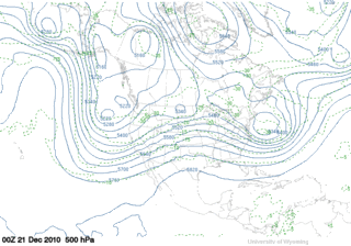
Look familiar?
GooFuS has a coastal storm on the 7th as well; however...its genesis is in the northern stream leaving the SW bowling ball behind.


Beautiful imagery from NASA/s Earth Observatory showing surface air temperature anomalies resulting from persistently negative Arctic Oscillation. Red (blue) areas are warm (cold) surface air temperature anomalies. "This image shows the temperature of the land surface for December 3-10, 2010 compared to the average temperature for the same period between 2002 and 2009."
The monthly Arctic Oscillation index has been below zero...15 out of 18 months since JUN-09. The AO fell to an all time low of -4.266 in FEB-10. Last winter's D-J-F average was -2.587.
Persistent HIGH pressure...often associated with a weak polar vortex (PV)...over the north pole allows arctic air to drain into low latitudes. Daily AO values have been negative since mid-NOV. This goes against type considering the QBO is in its westerly phase where the AO is typically positive...a consequence of a strong...cold PV.


