Sunday, December 09, 2007

ECHAM/s November Outlook - Verification


Appears to be another miss grande.


In the ECHAM image...red (blue) indicates negative (positive) pressure anomalies.
In the PSD image...red (blue)indicates negative (positive) pressure anomalies.

ECHAM/s November forecast expected positive pressure anomalies along the International Date Line (180°) The verifying analysis shows positive pressure anomalies.

ECHAM/s November forecast expected negative pressure anomalies over the PAC NW and the North Atlantic. The verifying analysis shows positive pressure anomalies.

Alberta Clipper - 05 DEC 2007


Source:
NASA Earth Observatory

An energetic clipper system put 3 - 7" of high-fluff snow on the ground in the DCA - BWI - ACY area last Wednesday. Forecasts generally underestimated the storm-total snowfall.

Temperatures in the crystal factory were -12°C...the low end of favorable conditions for growing stellar dendrites. Other contributing factors were 1) strong veering vertical wind profile...2) 'moist' boundary layer...3) column stretching as the impulse migrated east of the mountains...4) track of the 5H vort max...and 5) SN:H20 of 30:1...all of which were well-modeled by NWP well in advance of the event.

Saturday, December 08, 2007

More Like '55


The images shown below depict time-section plots @ 5H between 20N° and 90°N using NCEP daily data (operational and re-analysis) of CLIMO...current...and CPC/s seven La Nina years for the period 15 November through 07 December.

Any similarities / analogs between current conditions and conditions from past La Nina years?

1955...perhaps?


CLIMO..........Current..........1970..........1988


1950..........1955..........1973..........1975


The winter of '55 / '56 featured a strong La Nina that began in early '54 and continued for almost two years until the very end of '56. PDO was negative...as were most winters back then. PDO these days has bi-polar tendencies. QBO flipped E in January -- it/s E now having peaked in OCT. AO ranks 36 out of 57 years. NAO ranks 52 out of 57 years.

'55 doesn/t show up on any analog for this winter...but there it is. Best qualitative match with mid-level geo-potential heights during the past three weeks.


Make your own...
Time Plots / Hovmoller diagrams

Image credit:
NOAA/ESRL Physical Sciences Division, Boulder Colorado

Thursday, December 06, 2007

Contest # 1 - Results


Chief Forecaster donsutherland1 issued the best forecast for Storm #1. He placed 1st in "SUMSQ Error'...'Total Absolute Error'...'Average Abosulte Error' and 'R²' categories of forecast skill.

Full results @ the Contest web site.
Follow the link to Forecast #1 to see full forecast verification
Follow the link to Results #1 to see forecast and contest summary information.


Click to Enlarge

Wednesday, December 05, 2007

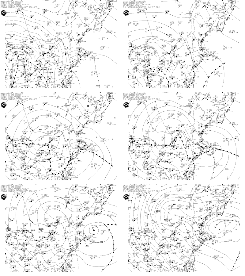
Contest # 1 - Surface Analysis


Click to Animate

Contest # 1 - Verification


Preliminary storm-total snowfall based on final CDUS41 bulletins from Sunday...Monday...and Tuesday.

New daily records
12/4
BGR: 12.3" (8.8"; 1989)
JFK: 0.9" (0.1"; 2003)

12/5
BGM: 2.4" (1.4"; 1972)

Please report any errors in 'Remarks' along with a link to the correct data.

Final results and contest summary will be posted Thursday evening.

Monday, December 03, 2007

Bully Wind

Rapid deepening of the surface LOW in the Gulf of ME today ginned-up a good bully wind along the east coast from VA to ME.

Buoy 44018 is 20 SE of Nantucket


The 24-hr pressure fall was ~1.2" Hg (~40 mb)...far exceeding NCEP/s 'Heavy Snow' prognostic expectation of a 20-30 mb deepening.

Strong WNW flow whipped around the backside of the LOW..too...screaming past Buoy OSGN6 from across Lake Ontario near Oswego...NY.


Make your own...
Northeast USA Recent Marine Data

Trends in NHEMI Snow Cover


Tony Wood of the Philadelphia Inquirer writes in his Weather or Not column today about trends in NHEMI snow cover. Areal coverage has been decreasing and the spring melt has come earlier. An earlier post on NEWxSFC suggested similar trends.

Tony reports some interesting observations made by Rutgers University/s geography professor David Robinson and AER atmospheric scientist Judah Cohen on the subject and what it all might mean.

"First, and curiously, the snow cover in other seasons (summer, fall and winter) hasn't shown big changes, Robinson says.

"Second, after falling off in the late 1980s, reaching a record low in 1990, the snow cover rebounded - until three years ago. So the decreases in complete calendar years 2004, 2005 and 2006 could constitute an anomaly.

"Third, Robinson, who contributed to the blue-ribbon Intergovernmental Panel on Climate Change (IPCC) reports, says that one could make the interesting argument that the world is warmer because of less snow.

"It's a chicken-egg question," he says.

Judah Cohen adds...
"The physical mechanism isn't fully understood, Cohen says, but fall snow coverage evidently affects air pressure patterns that influence other changes: An above-normal snowpack in Siberia in October correlates with below-normal temperatures in the United States in winter.

"October is the key, Cohen believes, because when the sun is strongest (summer), the snow is scarce; when the snow cover peaks (winter), the sun is absent. October has both."

More...
Rutgers University Snow Lab
sCAST from AER...Inc

Sunday, December 02, 2007

Contest # 1 - Teleconnections


Sharp decline in AO and NAO the right before the storm day. Small rise in otherwise flat / negative PNA.

Near-simultaneous drop in AO / NAO and rise in PNA reflect L/W amplification associated with the storm.

Contest # 1 - The Forecasts

(updated below)


Click to Enlarge

Sixteen Fifteen forecasters...one rookie...and one late entry pending approval

Storm Total Precipitation (STP) forecasts range from a low of 55.7" (smadsen8486) to a high of 108" (Mitchel Volk).

Average STP is 78.9"

Clearly a northern New England event...where the consensus heavy snow axis (+6") extends from BTV - CAR - BGR - PWM - CON - BTV.

All individual forecasts have been posted to the NEWxSFC web site. Follow the link to 'Contest # 1 - The Forecasts'. The forecasts are ranked from minimum to maximum STP for all stations.

UPDATE: The 16th entry was disqualified b/c the forecaster took into account model data not available to other forecasters who entered on deadline.

The forecasts posted on the web site will be updated during verification.