Sunday, March 26, 2017

Winter '16 / '17 - Snow Storm #4: NESIS

Rank:  23
NESIS:  5.03
Category:  3
Description:  Major

Large format image here.

---
NOAA has yet to report how many square miles the storm covered and how many millions of people it affected.

Friday, March 24, 2017

Winter '16 / '17 - Interim Standings: 2

Under the ‘two-thirds’ rule … forecasters who have entered at least THREE forecasts are included in the interim standings.


---
Complete interim statistics table and charts at the Contest/s web site here.
Forecaster verification statistics for Winter '16 / '17 contest storms here.

---
SUMSQ errors for each contest snow storm are normalized with a 'Z-score' ... then averaged to compute the standings. If a forecaster has issued forecasts for more than two-thirds of all snow storm contests ... then Z-scores from their 'best two-thirds' forecasts are used to calculate the Interim and Final standings.

Same idea as dropping the lowest quiz score before computing the final grade.

Saturday, March 18, 2017

Winter '16 / '17 - Snow Storm #4: FINAL Results

UPDATE:
THX to Forecaster Roger Smith for alerting us to important errors in the STP verification data (forgot in include 13-MAR snowfall - 1D10T error).  Stats and standings have been corrected.

-----------------
Original post 17-MAR-17 @ 10:15 PM EDT
-----------------
Forecaster's station verifications and the storm summary at NEWxSFC/s home page.
http://www.newx-forecasts.com/

     
 1st - Shillelagh 
 SUMSQ:864  
 SUMSQ Z:-1.627  
 STP:28.9 (5) 
 TAE:86.8 (1) 
 AAE:3.47 (1) 
     
 2nd - WeatherT 
 SUMSQ:1264  
 SUMSQ Z:-1.024  
 STP:45.8 (9) 
 TAE:129.0 (3) 
 AAE:5.16 (3) 
     
 3rd - Brad Yehl 
 SUMSQ:1401  
 SUMSQ Z:-0.816  
 STP:46.3 (10) 
 TAE:133.1 (4) 
 AAE:5.32 (4) 
     
 HM - JessicaCain 
 SUMSQ:1417  
 SUMSQ Z:-0.792  
 STP:49.1 (11) 
 TAE:138.1 (5) 
 AAE:5.53 (6) 


Thursday, March 16, 2017

Winter '16 / '17 - Snow Storm #4: Preliminary Verification

Table of preliminary storm-total snowfalls for TUE and WED from CDUS41 and CXUS51 bulletins.

Exceptions:
HYA
Storm-total snowfall report from PNSBOX.

ORH and BDL
15-MAR/s daily CLI and CF6 bulletins carry 'MM' as daily snowfall at post-time.  Daily snowfall total assessed as 'T' after evaluation of METARs.  Value subject to change pending CDUS41 and CXUS51 bulletin updates.

 SBY and RIC
 METAR reports of PL

---
Stations observed at least:
Trace - 25
4" - 17
6" - 14
8" - 11
10" - 11
12" - 11
15" - 6
18" - 2

Max melt-water at BGM (1.92")
Other stations with > 1" melt-water:
MDT (1.75")
ALB (1.58")
ORH (1.54")
BDL (1.54")
ABE (1.28")
BTV (1.13")
PWM (0.99")

Snow-Liquid Ratios (SLR) for areas with mixed precipitation ... such as ISP and JFK ... are not reported.

---
15 new daily records.
14-MAR-7
BGM - 31.2" (5.9"; 1991)
BTV - 17.8" (10"; 1980)
ALB - 17" (12.9"; 1958)
PWM - 16.3" (10.6"; 1961)
CON - 15.6" (6.6"; 1984)
MDT - 14.7" (8.3"; 1999)
ORH - 14.4" (11.5"; 1958)
ABE - 12.4" (8.4"; 1958)
BDR - 7.1" (3"; 1958)
EWR - 7" (4.6"; 1958)
BOS - 6.6" (3.8"; 1942)
JFK - 5.1" (2.1"; 1999)
IAD - 4.1" (4"; 1999)
ISP - 3.4" (2"; 1999)

15-MAR-17
BTV - 12.6" (4.1"; 1940)


Please report any errors in Comments along with a link to the correct data.
Final results expected NLT FRI evening.


Monday, March 13, 2017

Winter '16 / '17 - Snow Storm #4: The Forecasts

Rookie 1
Intern 0
Journey 0
Senior 13 (includes NWS)
TOT 14

Forecasts are ranked by their storm-total precipitation (STP).

BLUE ==> 25th percentile
RED ==> 75th percentile
White STP cells range between the 25th and 75th percentile.

Heaviest snowfall (>= 15") consensus along and the right of CAR - BGR - PWM - BOS - ISP - ORH - CON - CAR with a closed action center around ABE.  Lollypop expected at ORH.

What's that conventional wisdom about the NAO and NE snowstorms again?

---
Everyone/s station-by-station forecasts posted to NEWxSFC/s web site @ http://www.newx-forecasts.com/

Preliminary snowfall verifications will probably be posted FRI evening as long as significant snowfall doesn't extend into FRI.
FINAL results possibly by SAT evening.

Saturday, March 11, 2017

Winter '16 / '17 - Snow Storm #4: Call for Forecasts!

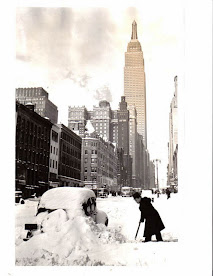
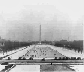
NYC
19-MAR-56
So much for spring giving winter the bum's rush!

Forecast element: storm-total snowfall
Deadline for entries:
10:30 PM EDT ... SUN ... 12-MAR-17
Verification period begins:
12:01 AM EDT ... MON ... 13-MAR-17
Verification period ends:
When the flakes stop flyin'

Enter your forecast at the NEWxSFC/s home page @ http://www.newx-forecasts.com/
Follow the top-of-page link from 'Enter Storm Forecast.'

---
As always ... there/s no cost ... no fees ... no advertising ... nor annoying requests for personal information to enter a forecast.  It's just a fun exercise for winter wx enthusiasts to see who can make the best synoptic-scale snowfall forecast.

---
If you are issuing your first forecast this winter ... or you entered the 'season-total' forecast contest ... you/ll need to create an account (user name / password ) and a valid e-mail ... if you want a copy of your forecast sent to your Inbox.

---
Contest may be cancelled before deadline if storm appears to fizzle.

---
Post has been updated to correct the month of the verification period beginning

Friday, March 10, 2017

Winter '16 / '17 - Today's Unworthy Snow Storm

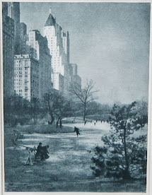
NYC
Alfred Stieglitz (1870s)

UPDATE (11-MAR-17 @ 11:30 EST)
Yesterday's system turned out to be more of a nuisance than anything else and certainly not contest-worthy.

Plowable snowfall (inches):
HYA - ~7
ABE - 4.5
PVD - 4.4
BDR, ISP - 4

---
Yesterday afternoon, NWP models and operational weather forecasters finally caught on to today/s marginally contest-worthy snow storm over the northern M-A and coastal SNE.  This coming after several days and multiple runs suggesting skimpy snowfall totals i.e., less than plowable ... and unwelcome liquid precipitation over the forecast stations.

Not the first time this has happened this season nor seasons in the past; however ... it does point to a significant lack of consistent ability to forecast snow storms where the storm-total may or not be plowable and whether the event is contest-worthy.

---
Some have suggested issuing a 'Call for Forecasts' whenever it appears there's a chance for a contest-worthy snow storm.  If were only that simple!

A fair amount of work comes with issuing a 'Call for Forecasts'.

Hundreds of email invitations have to been sent (50 at a time ... 30' apart so as not to be flagged as spam by your ISP or blocked by my ISP).
The contest/s web site has to be updated.
The contest/s web log has to be updated.
The contest/s Facebook page has to be updated.

Then it becomes a judgment call deciding whether the storm was contest-worthy (six to eight stations with more than nuisance storm-total snowfall i.e., >= 4").

Collecting surface ... upper air ... and remote sensing data used in the final analysis and storm summary reporting takes time while the event is unfolding. All for naught if the storm fizzles.

Believe you me ... no one is more disappointed when a snow storm slips through the cracks.

Bottom line: a contest-worthy storm has to be reasonably well predicted by the numerical models and WPC 24-to-36 hours before the first flakes fall for a 'Call for Forecasts' to be issued.

---
Final thought:
The number of forecast stations affected with more than nuisance snow totals is one of several criterion for deciding whether a snow storm is contest-worthy.  The number ranges between six and eight.

In this case ... the number of stations would have been eight instead of six.
The reason:  EWR ... BDR ... JFK .. and ISP are relatively close together as are PVD and HYA and there'd likely be relatively small variations in the storm-total snowfalls between stations.

Saturday, March 4, 2017

Winter '16 / '17 - Season-total Snowfall Forecast Contest: FEB totals

Station snowfall summary for FEB-17.
Rank ordered by percent of monthly normal.

 
Station snowfall summary for Winter '16 / '17 - Season-to-date through FEB

Green ==> 75th percentile
White ==> Less than 75th and greater than 25th percentile
Red ==> 25th percentile

---
Teleconnection indexes and month-over trend (updated as they become available)
AO:  0.340⇩
NAO:  1.00⇧
PDO:  0.70⇩
QBO:  14.78⇩
SOI:  -2.2⇩

---
⇩⇧⇔