Sunday, November 05, 2017

Winter '17 / '18 - Eurasia Snow Cover - OCT - Snow Advance Index (SAI)

OCT-17's snow advance index is negative.
Snow Crow suicide watch now in effect.

---
AER reports a statistically significant correlation between their 'winter severity index' and how quickly Eurasian snow cover advances during OCT.

They define the 'winter severity index' by the state of the North Atlantic Oscillation / Arctic Oscillation (N/AO) and interpret it as an indicator of 'high latitude' blocking potential during D-J-F.

More blocking.
More winter.
More better.

Here's the model ...
"When snow cover advances rapidly (slowly) across Eurasia in October, this is an indication that the upcoming winter will be more severe (milder) for the Eastern US [sic], Europe and East Asia.


Study period seems surprisingly short seeing how contiguous monthly Eurasian snow cover data begins in 1970.  How well does the SAI correlate with the N/AO index prior to 1988?

---
Snow Advance Index (SAI) backgrounder from AER here.
Earlier Eurasia snow cover posts here.

Sunday, October 29, 2017

Winter '17 / '18 - Eurasia Snow Cover - OCT Preview

Cohen projecting above normal Eurasia snow cover for OCT ahead of an expected weak La Nina winter (D-J-F).

Nine previous weak La Nina winters ... including the famed 1995 - 1996 season ... have been observed during the Eurasia snow cover period of record (1967 - 2016). Only two NEWxSFC forecast stations -- BGM and ALB -- have a statistically significant correlation between season-total snowfall and above normal Eurasia snow cover.


Related:
Winter '17 / '18 - Correlation of Eurasia's OCT Snow Cover and Season-total Snowfall in NE and M-A Regions 

Winter '17 / '18 - First Contact

Post-frontal ... elevation snows INVOF UVM associated with SFC LOWs

Boone ... NC (3146' MSL)
KTNB 291615Z AUTO 30013G25KT 4SM -SN SCT008 BKN014 BKN020 02/01

Richlands ... VA (2653' MSL)
KJFZ 291555Z AUTO 32004KT 3SM -SN SCT004 BKN007 OVC014 00/00 A2972 RMK AO2 T00011001

Wise county ... VA (2684' MSL)
KLNP 291555Z AUTO 31004KT 1 1/2SM -SN OVC003 00/00

Hot Springs ... VA (3793' MSL)
KHSP 291555Z AUTO 29014KT M1/4SM -SN OVC003 02/02

Bluefield ... WV (2856' MSL)
KBLF 291552Z AUTO 31008KT 1 3/4SM -SN BR BKN006 OVC012 00/M01

Bedford county ... PA (1161' MSL)
KHMZ 291555Z AUTO 32006KT 5SM -SN OVC010 07/06

Thursday, October 26, 2017

Saturday, September 23, 2017

Winter '16 / '17 - Arctic Oscillation (AO) Analog Verification

The analog forecasting technique seeks similarities to the AO state during the multi-month run-up to the coming winter with same AO run-ups of winters past.

The NEWxSFC method ranks analog years by their the sum of square errors (SSE) statistic.
Lower SSE errors ==> stronger analog

Arctic Oscillation (AO) Index Analog Forecast Verification

In the run-up to Winter '16 / '17 ... the leading analog was '12 / '13 followed by '73 / '74 ... '02 / '03 ... '74 / '75 ... and '88 / '89.  A qualitative assessment of the forecast's accuracy would rate the top three analogs as 'poor' ... IOW ... useless.

Winter '12 / '13 NAO oscillated weak negative to strong negative; whereas ... Winter '16 / '17 was essentially a mirror opposite.  The closest analogs ... on the basis of the AO remaining positive throughout the three-month forecast period ... were ranked last ('88 / '89) and next to last ('75 / '76).

Conclusion:  The top three Winter '16 / '17 AO analogs showed little ... if any ... skill.

---
An alternative forecasting technique looks at the AO's sign for any calendar-year's month preceding the pending winter as a potential leading indicator of the AO's sign for D-J-F period.

Results from a chi-square 'test for independence' infers a statistically significant relationship ... at the 95% confidence level and a p-value < 0.05 ... between NOV's AO sign and AO's sign of the upcoming D-J-F period.  IOW ... if NOV's AO is negative (positive) ... then average AO state during the upcoming winter will also be negative (positive); although the classification model is stronger ... i.e., lower false alarm rate ... for the predictor's month with a negative sign than positive.

Conclusion:  If NOV's AO is negative ... chances are good the AO state will average negative during D-J-F period.

---
Period-of-record AO data here.

Friday, September 15, 2017

Winter '16 / '17 - North Atlantic Oscillation (NAO) Analog Verification

The analog forecasting technique seeks similarities to the NAO state in the run-up to the coming winter with NAO run-up states of winters past. 

The NEWxSFC method ranks analog years by their the sum of square errors (SSE) statistic.
Lower SSE errors ==> stronger analog
Constraining the number of analog winters for analysis to five is arbitrary.

North Atlantic Oscillation (NAO) Index Analog Forecast Verification
In the run-up to Winter '16 / '17 ... the leading analog was '08 / '09 followed by '51 / '52 ... '54 / '55 ... '74 / '75 ... and '11 / '12.  A qualitative assessment of the forecast's accuracy would rate the top four analog as 'poor' ... IOW ... useless.

Winter '08 / '09 NAO was negative to neutral trending positive into MAR; whereas Winter '16 / '17 was weakly positive trending moderate.  The closest analog ... on the basis of the NAO remaining positive throughout the three-month forecast period ... was ranked last ('11 / '12).

Conclusion:  Winter '16 / '17 NAO analogs showed little ... if any ... skill.

---
An alternative forecasting technique looks at the NAO's sign for any calendar-year's month preceding the pending winter as a potential leading indicator of the NAO's sign for D-J-F period.

Results from a chi-square 'test for independence' infers a statistically significant relationship ... at the 95% confidence level and a p-value < 0.05 ... between NOV's NAO sign and NAO's sign of the upcoming D-J-F period.  IOW ... if NOV's NAO is negative (positive) ... then the average NAO state during the upcoming winter will also be negative (positive); although the classification model is stronger ... i.e., lower false alarm rate ... for the predictor's month with a positive signs than negative.

Conclusion:  If NOV's NAO is positive ... chances are good the NAO state will average positive during the D-J-F period.

---
Period-of-record NAO data here.

Thursday, April 20, 2017

Winter '16 / '17 - 18th Annual 'Regular Season' Snowfall Forecast Contest: FINAL Results


Four contest-worthy storms this season.  Tied with Winter '05 / '06 for 15th place.
Under the ‘two-thirds’ rule … forecasters who entered at least THREE forecasts are included in this season's FINAL standings..

---
Top 5 Forecasts (Error statistic:  SUMSQ)
SUMSQ is the primary measure of forecaster skill (lower the better).
Accounts for the magnitude and distribution of the storm-total snowfall for all stations.

---
Top 5 Forecasts (Error statistic:  Total Absolute Error - TAE)
TAE is the secondary measure of forecaster skill (lower the better).
Accounts for the magnitude of snowfall at each station.

---
Top 5 Forecasts (Error statistic:  RSQ)
RSQ is a supplementary measure of forecaster skill (higher the better).
Accounts for how well the variability of the observed snowfall was accounted for by the forecast.


---
Average Z-scores for Forecasters who submitted entries for all four snow storms.

---
Winter '16 / '17 was only the third season without a JAN snow storm.
 
---
Hope to see y'all again next winter.

Saturday, April 08, 2017

Winter '16 / '17 - 18th Annual 'Regular Season' Snowfall Forecast Contest: The End is Nigh

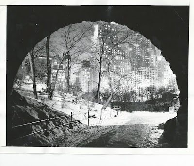
Central Park ... NYC
19-FEB-41
Despite our longing for one more contest-worthy snow storm ... the long wave pattern shows little inclination to alter its ridiculously stubborn regime of processing 'all' SFC LOWs through the Great Lakes region.

Sure hasn/t been a great season for nor'easters in general or nor'easters climbing the coast from low latitudes specifically.

Most seasons ... it/s all said and done by early MAR.
Average date of the last 4" or greater snowfall:
CAR 23-MAR
BGR 15-MAR
PWM 08-MAR
ORH 07-MAR
BTV 06-MAR
CON 06-MAR
ALB 06-MAR
BGM 06-MAR
BOS 25-FEB
BDL 24-FEB

However ... there are exceptions.
Latest date of the last 4" or greater snowfall:
CAR 16-MAY
PWM 11-MAY
CON 10-MAY
ALB 10-MAY
ORH 09-MAY
BGR 24-APR
BTV 23-APR
BGM 22-APR
BDL 21-APR
BOS 10-APR

Source:
NOWData http://www.nws.noaa.gov/climate/index.php


The end of the Winter '16 / '17 snowfall forecasting season appears nigh.
All else equal ... the season will close on SAT ... 15-APR.

Sunday, April 02, 2017

Winter '16 / '17 - 16th Annual 'Season-total' Snowfall Forecast Contest: FINAL Results


Complete station-by-station forecaster verifications at the Contest/s web site here.

Two perfect forecasts
Donald Rosenfeld 100" @ CAR
Mitchel Volk 15" @ PHL

Near misses
Jessica_wxgirl 0.05" error @ RIC (7.2")
Shillelagh and Jessica_wxgirl 0.1" error @ MDT (23.9")
donsutherland1 0.1" error @ ORH (75.4")
MillVillWx 0.2" error @ ALB (58.3")
kevinmyatt 0.2" error @ NYC (30.2")
weathermbug ... TQ ... and DAROOSTA 0.2" error @ SBY (9.8")
Herb @MAWS and weathermbug 0.2" error @ ORF (5.4")
snowman 0.3" error @ BTV (91.7") and 0.2" error @ EWR (31.4")
Donald Rosenfeld 0.5" error @ BGM (104.5")


Season-total snowfall from all stations (1041") came in 14% above the period-of-record normal (914").  Winter '16 / '17 ranks 6th highest among other Contest years since winter '04 / '05 ... the season when BGR and BGM were added to the station list.