Friday, October 30, 2009

9th Annual 'Season-total' Snowfall Forecast Contest


CALL FOR FORECASTS

Deadline: Monday...30 November...2009 @ 11:59 PM EST

Forecast the season-total snowfall for 25 stations from RDU to CAR.

Visit the Contest's website to enter your forecast. Follow the link from 'Enter Season-total Forecast.'

As always...there/re no costs...fees...or annoying requests for personal information to enter.

NE.Wx/s annual ‘Season-total' Snowfall Forecast Contest is your absolute best...biggest...and probably ONLY chance to be recognized for your long-range forecasting acumen; a recognition you so richly deserve.

Not only that...but if you win the Contest...you get a copy of "The Snow Booklet"...by Nolan J. Doesken and Arthur Judson or "New England Weather New England Climate"...by Gregory Zielinski and Barry Keim delivered right to your front door.

What other incentive could you possibly want to enter the Contest ?

How about F-R-E-E shipping?  DONE!
________________________________________________

Forecast element: sum-total season snowfall @ each station
Forecast period: December 1, 2009 through March 31, 2010
Verification: NWS preliminary climate reports (CLM or F6)
Error statistic: total absolute error [Σ abs(forecast - observed)]
Deadline: Monday...30 November...2009 @ 11:59 PM EST
________________________________________________

The reigning NE.Wx ‘Season-Total’ Snowfall Forecasting Champ-een is TQ.
Last year/s forecast summary and final results here.

The Contest is open to any and all of the following:
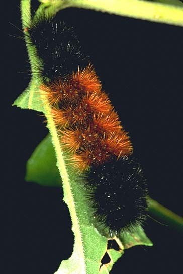
Amateur and professional forecasters; broadcasters with or without trained Seals; weather-biz types and wanna-bees; wish-casters...astro-meteorologists...and other classes of dreamers; Pollyannas or Cassandras; registered Nostradamusians; non-violent megalomaniacs; woolly-bear caterpillars or their agents; pest detectives...NE.Wx Usenet NG or GoogleGroup regulars and lurkers...refugees from EUSWx...StormVista...Golden Snowball...energy sectarians...and meteorologists.

Trolls...goats...hat3-lsiters...and psests need not apply.

Thursday, October 22, 2009

Winter '09 / '10 - Too Much...Too Soon?


How much longer can the current flow regime support 'Nor-easters R-Us'?

Full-latitide mean trof axis INVOF 80°W
Bagginess @5H
Cyclogenesis off the SE coast
Crashing AO currently @-2.535 (-4.87 index delta past 30 days)

All good things must come to an end...to coin phrase. Forecasters must always face facts...flow regimes don/t last forever.

What are the realistic chances the current pattern continues deep into winter?  Is this too much...too soon?

Monday, October 19, 2009

Winter '09 / '10 - WSI - October Update

Dr. Todd Crawford - seasonal forecaster:
"The WSI winter forecast for December through February shows below-normal temperatures across the eastern and southern United States, with above-normal temperatures across the northwestern half of the country.

""Recent changes in Pacific Ocean temperatures along with other factors, such as reduced solar flux, have combined to produce a favorable environment for a cold winter in the eastern U.S. this year...

""Confidence in the cold winter forecast will increase further if snow cover builds rapidly at higher latitudes during October. Our current forecast indicates a relatively benign start to winter, followed by a rather active and cold January and February."

"In December, WSI sees the monthly breakdown as:
Northeast - Warmer than normal

"In January, WSI forecasts:
Northeast - Colder than normal"
Reuters
PRWeb

Sunday, October 18, 2009

Saturday, October 17, 2009

Winter '09 / '10 - October Snowfall Records

From NWS Public Information Statements (PNS)...

...RECORD DAILY MAXIMUM SNOWFALL SET AT BINGHAMTON NY...
A RECORD SNOWFALL OF 1.2 INCHES WAS SET AT BINGHAMTON NY YESTERDAY (10/15). THIS BREAKS THE OLD RECORD OF A TRACE SET IN 1995.
...RECORD DAILY MAXIMUM SNOWFALL SET AT BINGHAMTON NY...
A RECORD SNOWFALL OF 0.8 INCH(ES) WAS SET AT BINGHAMTON NY YESTERDAY (10/16). THIS BREAKS THE OLD RECORD OF 0.5 SET IN 1982.
...DAILY SNOWFALL RECORD SET AT ALBANY...
ON FRIDAY...OCTOBER 16...2009...A TRACE OF SNOW WAS RECORDED IN ALBANY AT 830 AM EDT. THIS IS THE FIRST RECORDED SNOWFALL EVER ON THE DATE OF OCTOBER 16...WITH SNOWFALL RECORDS GOING BACK TO 1884.
...RECORD DAILY MAXIMUM SNOWFALL SET AT BRIDGEPORT CT...
A RECORD SNOWFALL OF TRACE INCH(ES) WAS SET AT BRIDGEPORT CT TODAY.THIS BREAKS THE OLD RECORD OF 0 SET IN 2001.
...RECORD DAILY MAXIMUM SNOWFALL SET AT WORCESTER MA...
A TOTAL OF 1.4 INCHES OF SNOW FELL AT WORCESTER AIRPORT ON FRIDAY. THIS SETS A RECORD FOR SNOWFALL ON OCTOBER 16. THIS IS THE FIRST TIME THAT SNOW FELL ON THIS DATE SINCE RECORDS BEGAN IN THE WORCESTER AREA..DATING BACK TO 1892.

THIS EARLY SNOW IS NOT THE EARLIEST ON WORCESTERS (sic) RECORD. THE EARLIEST MEASURABLE SNOWFALL WAS 0.4 INCHES WHICH OCCURRED ON OCTOBER 8 1988. THE HEAVIEST OCTOBER SNOW WAS 7.5 INCHES THAT OCCURRED ON OCTOBER 10 1979.
...RECORD DAILY MAXIMUM SNOWFALL SET AT HARTFORD CT...
A TRACE OF SNOW FELL AT BRADLEY INTERNATIONAL AIRPORT IN WINDSOR LOCKS ON FRIDAY. THIS SETS A RECORD FOR SNOWFALL FOR OCTOBER 16. THIS IS THE FIRST TIME SNOW FELL ON THIS DATE SINCE RECORDS BEGAN IN 1905.

Ever wonder why the NWS tolerates poor grammar and spelling in the statements its employees make to the public?

Winter '09 / '10 - NHEMI Snowcover mid-October - Update


Snow anomaly chart shown above was produced 14-OCT...two days before the on-going...record-breaking snowfall over the forecast area.

The large spike in mid-October snowcover is not unprecedented...altho it/s been absent in recent years.

More snowcover charts here.

Previous update here.

Northeast snowcover map (VT 17-OCT-09) courtesy NOHRSC.

Global snowcover anomaly map (VT 16-OCT-09) courtesy Rutgers Global Snow Lab


Friday, October 16, 2009

Winter '09 / '10 - Record-setting Early Snowfall - NY


"The storm that brought an early snowfall to parts of the Ithaca area on Thursday and Friday set a record for the earliest snowfall of 1 inch or more.

"The previous record for an early snowfall exceeding 1 inch was Oct. 17, 1970 when 4 inches of snow fell in the Ithaca area."
The Ithaca Journal

Winter '09 / '10 - Planalytics - October Update

Jim Rouiller - Meteorologist:
"An early and cold start to winter and a milder finish, with the potential for early snowpack in Canada to intensify the cold air sweeping into the United States.

"Into January, the jet stream associated with El Niño will make the South the dominant player in the U.S. weather pattern.

"In January the North Atlantic Oscillation will be negative, which can mean periodic shots of very cold air and establish a storm trend, which means a higher snowstorm threat."
Reuters

Last month/s Planalytics outlook here.

Thursday, October 15, 2009

Winter '09 / '10 - Unseasonably Heavy Snowfall...High Wind Bring Chaos to Poland


"At least four Polish people were killed as the first snowstorms of the winter blew through central Europe, toppling trees, severing power lines and disrupting energy supplies.

"...700,000 people were left without electricity on Wednesday night, fallen trees blocked roads and rail tracks and huge waves damaged a pier at the Baltic resort of Sopot."

"In Ukraine, pipelines that carry about a fifth of Russian oil exports to Europe shut down after storms caused electricity shortages at pumping stations, affecting supplies to Hungary, Slovakia and the Czech Republic.

"There was mixed news for skiers: while Austria’s Alps recorded its biggest October snowfall in 25 years..."
More...

Winter '09 / '10 - October's ENSO Outlook

From The International Research Institute for Climate and Society

"The set of dynamical and statistical model forecasts issued during late September and early October 2009 are in general agreement of maintaining El Niño conditions through the end of 2009, although the magnitude differs among models. At the time of preparing this, the SST observations in the NINO3.4 region indicate weak El Niño conditions, with an area-averaged weekly anomaly of 0.7 C. Current forecasts and observations indicate a probability of about 90% for maintaining weak to moderate El Niño conditions through the end of the year."
Majority of the models suggest +ENSO reaching moderate strength this winter...fading to weak at the beginning of meteorological spring.

More...

Winter '09 / '10 - Record-setting Early Snowfall - PA

(updated below)

State College...PA and surrounding environs observed their earliest snowfall today...breaking the old record dating to October 18...1901.

At mid-day...a 2" snowfall was reported from Coudersport in Potter County and 1.5" in Haneyville.  About an inch had fallen in the Pocono Mountains.

Almost one-third of an inch has been observed in State College.

UPDATE:
4.5" reported as of late Friday afternoon with 2" more possible through Saturday morning.

Winter '09 / '10 - Building or Fading el Niño?

NOAA bets the farms on a building el Niño this winter while AccuWx leans the other way with its expectation of a fading +ENSO.

Despite the decidedly different expectations...their temperature and precipitation charts appear surprisingly similar.

SST measurements in ENSO Region 3.4 are currently reporting weak +ENSO conditions (12-week moving average SSTanom +0.7°C having peaked @0.9°C 16-Sep).  Anomalies have risen in Region 4 to 1.0°C as the center of action shifts toward the International Dateline.


Winter '09 / '10 - National Wx Circus


"Northeast: Equal chances for above-, near-, or below-normal temperatures and precipitation. Winter weather in this region is often driven not by El Niño but by weather patterns over the northern Atlantic Ocean and Arctic, such as the North Atlantic Oscillation. These patterns are often more short-term, and are generally predictable only a week or so in advance."
Despite NOAA/s caveat about the North Atlantic Oscillation with its implicit association with the Arctic Oscillation...the 'cooler' temperature outlook along the SE coast is predicated upon the Northern Annular Modes being negative...otherwise the temperature fields would look like this.

More...

Winter '09 / '10 - How Much for Balmer?

Frank Roylance...staff writer for the Baltimore Sun...also interviewed AccuWx/s Chief Meteorologist Joe Bastardi...who offered up additional details about what's in store for Baltimore this winter.
"Maryland is in for the coldest, snowiest winter we've seen since the memorable - and snow-choked - winter of 2002-2003.

"A "fading" El Niño, and a shift to a warm phase of the "Pacific Decadal Oscillation" will combine with "other factors," Joe Bastardi said, to shift the worst of this winter's weather from the Midwest, where it was concentrated last winter, to the mid-Atlantic states.

"Twenty-five inches at BWI, and 2.7 degrees below normal," he said, placing his bets on the season's total snowfall at the airport and the average temperature for the winter at BWI.

"Among the "other factors" he takes into account, in addition to El Niño and the Pacific Decadal Oscillation, are the prevailing weather conditions and how they compare with past winters - winter analogs. Looking at those, he sees similarities between this year's patterns and those that prevailed during the winters of 1976-77, which was very cold, and 1977-78, which saw 34 inches of snow at BWI.

"He also saw a resemblance to the winter of 1957-58, which brought 43 inches of snow to Baltimore and very wintry weather in February and March. Another "analog" he includes in his "package" is the winter of 1965-66, with 32 inches of snow."
Average season-total snowfall @BWI: 21.4" AccuWx/s expecting 17% more snow than normal.  Last year/s forecast was 20" with 9" observed.

BWI Monthly Snowfall Climo (58-year NCDC period of record)
DEC: 3.3"
JAN: 6.1"
FEB: 7.1"
MAR: 3.6"

More...

Winter '09 / '10 - How Much for Philly?

Anthony Wood...staff writer for the Philadelphia Inquirer...interviewed AccuWx/s Chief Meteorologist Joe Bastardi...who offered up a few additional details about what's in store for Philly this winter
"...temperatures to be about 2 degrees below average...with perhaps 30 inches of snow.

"I do think there are going to be a couple of big-ticket storms..."
Average season-total snowfall @PHL: 21" AccuWx/s expecting 43% more snow than normal.

PHL Monthly Snowfall Climo (66-year NCDC period of record)
DEC: 3.4"
JAN: 6.0"
FEB: 7.0"
MAR: 3.4"

More...

Wednesday, October 14, 2009

Winter '09 / '10 - AccuWeather - Update 2


Joe Bastardi...Chief Meteorologist:
"...winter will be centered over an area from Maryland to the Carolinas as a fading El Niño results in the stormiest and coldest pattern in recent years.

"The areas that will be hit hardest this winter by cold, snowy weather will be from southern New England through the Appalachians and mid-Atlantic, including the Carolinas. Areas from Washington D.C. to Charlotte have had very little snowfall the past two winters. This season these areas could end up with above-normal snowfall.

"Northern areas, including Buffalo, Boston and Maine, have been hit hard the past couple of winters, but will see normal snowfall with temperatures slightly below normal this winter.

"Cities such as New York, Boston and Philadelphia could get up to 75 percent of their total snowfall in two or three big storms."
This is a classic +ENSO / -Arctic Oscillation (AO) forecast with main precipitation track across the southern tier and Miller 'A' (.pdf) nor'easters up the east coast...although it does not appear to be a good fit with the accompanying temperature outlook...which matches closely to either a positive or neutral AO state.

More...

Tuesday, October 13, 2009

Early Snows in Austria

(updated below)

"Austria’s provincial capitals are expected to see their earliest snowfalls in history today (Mon) as Arctic air sweeps the country."
[...]
"The (previous) record for early snow in provincial capitals was set in 2007, when snow remained on the ground in some of them from 20 to 24 October."

More...

UPDATE:
"Austria sees biggest October snowfall in 25 years"

"Austria was hit by a record October snowfall late on Tuesday when strong winds and heavy snow caused power blackouts, train delays and traffic accidents.

"...also predicted...30 and 40 centimeters (12 - 16") of snow would be likely to fall this week."
More...

Snow Season Begins in Japan


From 'Snow Season Japan' blog...

"The first snowfall for the 2009/2010 winter season has arrived on the Hakuba peaks. Hakuba usually sees it’s first snowfall around the middle of October each season, so it’s bang on time. Everything is looking very promising
[...]
"In Japanese, we call the first snow is called Hatsuyuki, Hatsu meaning ‘first’ and Yuki meaning ’snow’"
More...

Winter '09 / '10 - NHEMI Snowcover mid-October

Anomaly / Observed


L-a-r-g-e swath of anomalous snowcover over the northern and central plains...the upper Midwest...and much of Canada.

Miles wide and an inch deep in many places but it/s a good start. Many stations saw their earliest snows on record and others weren/t far behind. Similar reports of early snows elsewhere...as well.

Images courtesy Rutgers Global Snow Lab

Wednesday, October 7, 2009

Winter '09 / '10 - Quick Hit Outlooks

US Department of Energy:
"...slightly milder weather than last winter..."
National Weather Service:
"...equal chances of a mild winter, normal winter or cold winter..."
Weather2000 (chief meteorologist Michael Schlacter):
"...probably average colder than normal and that we can look forward to dramatic swings in temperatures. It's going to be a cyclonic, volatile, wacky winter..."
AccuWeather (senior meteorologist Henry Margusity):
"...expect colder temperatures than last winter and more snow - almost twice as much as last winter's 28 inches in New York City. We're looking at this part of the country being on the cold side..."
More...

Monday, October 5, 2009

Winter '09 / '10 - Early October Snowcover

Judah Cohen...director of seasonal forecasting:

"Scant early snowfall in Siberia indicates Arctic wind patterns may reduce cold air flows into the Northeast U.S. this winter, contradicting forecasts that a weak El Niño will cause the coldest season in a decade, a climate scientist said.

“Our forecast for this winter is pretty warm,” Judah Cohen, director of seasonal forecasting at Atmospheric and Environmental Research Inc. in Lexington, Massachusetts, said yesterday at a conference in New York. “Siberian snow cover has been running well below normal."

"Cohen said a rapid buildup of snow in Siberia this month could alter his forecast that so-called Arctic oscillation patterns will create a warm Northeast.

"“In a week’s time, Siberia can get enough snow to cover the entire U.S.,” he said."
More...

Historical NHEMI Snow Cover 10/2

October 2 1997 - 2009


End of October 1997 - 2009

Appears 2008 Eurasian snowcover was fairly low compared to the other images....and last winter was notable for a good portion of the forecast area.

Associations Between ENSO and AO in Winter

A moderately warm ENSO event seems to be a lock this winter. The multi-variate ENSO Index (MEI) is bullish as are a majority of numerical and statistical ENSO forecast models...even though the Southern Oscillation (data) hasn/t made up its mind.

Conventional wisdom suggests this scenario favors a split-flow regime with an active...moisture-laden sub-tropical jet (STJ) and opportune phasing with the polar jet (PJ) and producing strong cyclogenesis along the eastern seaboard. Add arctic HIGH pressure over eastern Canada and it/s snow-time.

The graphic below was extracted from NCEP/Climate Prediction Center/s ATLAS No. 8 - Relationships Between El Niño-Southern Oscillation and the Arctic Oscillation: A Climate-Weather Link

It shows composite fields for 500 mb geo-potential height...surface temperarture...and precipitation during +ENSO and three phases (positive...neutral...and negative) of the Arctic Oscillation (AO).

Best-case for snow crows during warm ENSO is a negative AO (bottom row of charts).

Otherwise...the mid-level long-wave trof axis is suppressed to the south...(neutral AO) or there/s no trof at all (+AO) and temperatures are above normal with the best moisture contained across the Deep South and the Mississippi and Tennessee River valleys.

Sunday, October 4, 2009

Winter '09 / '10 - WSI

Todd Crawford - Seasonal Forecaster:

"A moderate El Nino event will likely persist through the winter, resulting in cool weather across the Southeast”[...]. “However, ocean temperatures in the North Pacific are not currently supportive of a typical El Nino pattern this upcoming winter. If this persists, this winter will likely be colder in the western US than is typical during El Nino events.

"In the Northeast, we expect a relatively mild fall, with increased chances of sharply colder weather after the New Year. The combination of various climate indices suggests that the winter will likely arrive late but loudly in much of the East, and that a mild start will not necessarily persist through the winter.

"In December, WSI forecasts:
Northeast – Warmer than normal"
More...

Saturday, October 3, 2009

North Atlantic Oscillation - September '09

+1.51

2007...2000...1956...1974...and 1999 are still the best NAO-analog years after the addition of September/s data point. Only change was '74 and '99 switching places from August/s rankings.

What/s it all mean...Mr. Peabody?

2007: -ENSO...+AO...-PDO...-QBO...sun spots below normal
2000: -ENSO...-AO...+PDO...-QBO...sun spots near normal
1956: -ENSO...+AO...-PDO...-QBO...sun spots above normal
1974: -ENSO...+AO...-PDO...-QBO...sun spots below normal
1999: -ENSO...+AO...-PDO...+QBO...sun spots near normal

El Niño more than likely this winter...so how much utility is there using NAO analog years given their unanamous association with -ENSO?